IMAGES TAKEN NEAR TO
Lower Penponds, CAMBORNE, TR14 0QJ
Introduction
This page details the photographs taken nearby to TR14 0QJ by members of the Geograph project.
The Geograph project started in 2005 with the aim of publishing, organising and preserving representative images for every square kilometre of Great Britain, Ireland and the Isle of Man.

There are currently over 7.5m images from over14,400 individuals and you can help contribute to the project by visiting https://www.geograph.org.uk
Image Map (Loading...)


Getting Data...Please wait
Leaflet Map data © OpenStreetMap
Images are licensed for reuse under creativecommons.org/licenses/by-sa/2.0
Notes
- Clicking on the map will re-center to the selected point.
- The higher the marker number, the further away the image location is from the centre of the postcode.
Image Listing (10 Images Found)
Images are licensed for reuse under creativecommons.org/licenses/by-sa/2.0
Image
Details
Distance
1
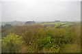
Abandoned Cattle Feeding Station
Judging by the grass growing from the silage, this feeding station has not been used for a while but it will take a while longer for ground so churned up by cattle to repair itself.
Image: © Tony Atkin
Taken: 24 Sep 2005
0.09 miles
2
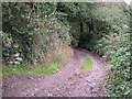
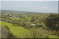
Hood Hill
This is officially a bridleway, but it looks more like an unmetalled road. This track up the hillside actually has an metal name sign at the bottom of the hill. It is so called because it skirts a hilltop enclosure known as The Hood.
Image: © Tony Atkin
Taken: 24 Sep 2005
0.11 miles
3
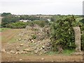
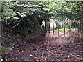
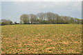
Grubbed up hedgerow
This hedgerow at the edge of a potato field appears to be in the process of being grubbed up. The large pieces of rock strewn around come from the hedgerow which typically in Cornwall have stone sides with a core of earth in which the hedgerow plants grow. The house across the valley is Polstrong Farm at SW628398
Image: © Tony Atkin
Taken: 24 Sep 2005
0.15 miles
6
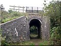
The mainline railway bridges Old Mill Lane
I suspect that when the railway was built this bridleway was a rather more important thoroughfare than it is now.
Image: © Tony Atkin
Taken: 24 Sep 2005
0.19 miles
7
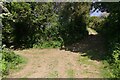
Track bends sharply
The track from the Hood Settlement bends sharply here.
Image: © Elizabeth Scott
Taken: 29 May 2023
0.20 miles
8
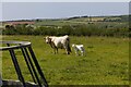
Cow and calf
A cow and her beautiful calf in the field at the point where the track from Hood Settlement bends sharply. The railway line borders this field, it's visible on the right of my picture. The distant chimney is the Roseworthy Arsenic Stack, see Image
Image: © Elizabeth Scott
Taken: 29 May 2023
0.23 miles
9
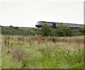
The Train to Paddington
These trains used to be known as "Intercity 125s" but are now more often referred to as HSTs (High Speed Trains). In Cornwall however they do not live up to their name. It takes two hours for any train to cross the length of the county. Despite being 30 years old, these are still the most comfortable trains around.
Image: © Tony Atkin
Taken: 24 Sep 2005
0.24 miles