
IMAGES TAKEN NEAR TO
Bell Lake, CAMBORNE, TR14 0JG
Introduction
This page details the photographs taken nearby to TR14 0JG by members of the Geograph project.
The Geograph project started in 2005 with the aim of publishing, organising and preserving representative images for every square kilometre of Great Britain, Ireland and the Isle of Man.

There are currently over 7.5m images from over14,400 individuals and you can help contribute to the project by visiting https://www.geograph.org.uk
Image Map
Images are licensed for reuse under creativecommons.org/licenses/by-sa/2.0
Notes
- Clicking on the map will re-center to the selected point.
- The higher the marker number, the further away the image location is from the centre of the postcode.
Image Listing (15 Images Found)
Images are licensed for reuse under creativecommons.org/licenses/by-sa/2.0
Image
Details
Distance
1

The footpath, leading to a country lane, residential homes across the lane
Image: © Pete Cruse
Taken: 22 Apr 2025
0.04 miles
2

Public footpath
This is a view of a public footpath as it approaches the hamlet of Coombe. Behind the viewpoint the path runs from a car park at North Cliffs / Reskajeage.
For a photograph of the footpath a short distance behind the viewpoint, click here Image
Image: © Alan Walker
Taken: 24 Sep 2017
0.06 miles
3

Road in Coombe
This easterly facing photograph was taken from a point where a Image joins the road. The building on the left is Coombe Cottage. Ahead a bridleway leads into Tehidy Country Park and just beyond that the road joins another at a T-junction.
Off the right hand edge of the photograph is the access road to Coombe Caravan Park.
Some 2km behind the viewpoint this road joins the B3301 near Hudder Down.
See also this photograph by Trevor Harris:- Image
Image: © Alan Walker
Taken: 24 Sep 2017
0.06 miles
4
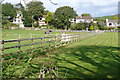
Paddocks at Coombe
Well groomed, and I'm sure much appreciated by the horses.
Image: © Graham Horn
Taken: 19 Oct 2011
0.07 miles
5

Public footpath
This is a view of a public footpath that runs from a car park (some 600m behind the viewpoint) at North Cliffs / Reskajeage Downs to the hamlet of Coombe.
In the distance, to the left of centre, is Cambourne.
For a photograph of the footpath a short distance ahead, click here Image
Image: © Alan Walker
Taken: 24 Sep 2017
0.09 miles
6

Lane in Coombe
Taken outside Coombe Cottage looking east.
Image: © Trevor Harris
Taken: 31 Mar 2017
0.10 miles
7

Houses in the valley at Coombe
This sheltered valley of the Red River is only a short distance from the wild North coast.
Image: © Rod Allday
Taken: 7 Dec 2008
0.10 miles
8

Bridge over leading to Public Bridleway, with marker posts for the edge of the road
Image: © Pete Cruse
Taken: 6 Aug 2025
0.13 miles
9

Tehidy Country Park
The photograph shows a bridleway as it enters the far south-western end of Tehidy Country Park.
Some 170m behind the viewpoint is a Image where a Image from a car park at North Cliffs / Reskajeage joins the road.
See also this photograph by Rod Allday:- Image
Image: © Alan Walker
Taken: 24 Sep 2017
0.13 miles
