
IMAGES TAKEN NEAR TO
Roscroggan, CAMBORNE, TR14 0JB
Introduction
This page details the photographs taken nearby to TR14 0JB by members of the Geograph project.
The Geograph project started in 2005 with the aim of publishing, organising and preserving representative images for every square kilometre of Great Britain, Ireland and the Isle of Man.

There are currently over 7.5m images from over14,400 individuals and you can help contribute to the project by visiting https://www.geograph.org.uk
Image Map
Images are licensed for reuse under creativecommons.org/licenses/by-sa/2.0
Notes
- Clicking on the map will re-center to the selected point.
- The higher the marker number, the further away the image location is from the centre of the postcode.
Image Listing (6 Images Found)
Images are licensed for reuse under creativecommons.org/licenses/by-sa/2.0
Image
Details
Distance
1
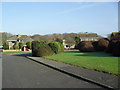
Tehidy Gardens
Landscaped gardens and 1970s houses in Tolvaddon.
Image: © Burgess Von Thunen
Taken: 1 Mar 2012
0.17 miles
2
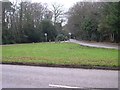
Green Triangle at South Tehidy
South Tehidy is an area of detached housing hidden amongst trees. This green triangle at a road junction is one of the few areas of open land.
Image: © Tony Atkin
Taken: 30 Dec 2005
0.17 miles
4
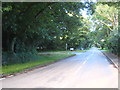
Mount Whistle Road South Tehidy
Looking towards Tolvaddon.
Image: © Rod Allday
Taken: 14 Jul 2012
0.22 miles
5
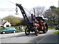
Trevithick Day Steam Parade through South Tehidy
Image: © Tim Warne
Taken: 27 Apr 2008
0.23 miles
6
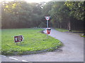
South Drive Tehidy
Originally the drive leading to Tehidy House, the home of the Basset family, it now leads to the country park established on the former estate.
Image: © Rod Allday
Taken: 14 Jul 2012
0.23 miles