IMAGES TAKEN NEAR TO
Trewithick Road, HELSTON, TR13 9QA
Introduction
This page details the photographs taken nearby to Trewithick Road, TR13 9QA by members of the Geograph project.
The Geograph project started in 2005 with the aim of publishing, organising and preserving representative images for every square kilometre of Great Britain, Ireland and the Isle of Man.

There are currently over 7.5m images from over14,400 individuals and you can help contribute to the project by visiting https://www.geograph.org.uk
Image Map
Images are licensed for reuse under creativecommons.org/licenses/by-sa/2.0
Notes
- Clicking on the map will re-center to the selected point.
- The higher the marker number, the further away the image location is from the centre of the postcode.
Image Listing (13 Images Found)
Images are licensed for reuse under creativecommons.org/licenses/by-sa/2.0
Image
Details
Distance
1
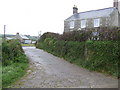
Trevorian Farm
A mile to the south-west of Breage.
Image: © Jonathan Billinger
Taken: 9 May 2007
0.01 miles
2
Dead end to Tregunno Farm
Leading off Trewithick Road, this narrow lane accesses Tregunno and Tranno farms.
Image: © Richard Law
Taken: 14 Oct 2015
0.08 miles
3
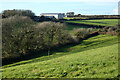
Pasture, Breage
Trewithick Farm is seen across the small valley between it and Tregunno Farm.
Image: © Andrew Smith
Taken: 2 Jan 2023
0.15 miles
4
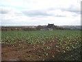
Field at Trewithick
Planted with broccoli (as cauliflower are known in Cornwall).
Image: © Rod Allday
Taken: 11 Dec 2012
0.16 miles
5
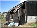
Barn near Colvorry Farm
This picture was taken from the footpath that runs through Colvorry Farm
Image: © Roddy Urquhart
Taken: 26 Jul 2008
0.17 miles
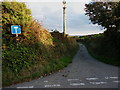
6
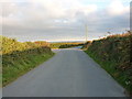
A minor road junction at Trewithick
Beacon Lane, running straight on, eventually leads into Porthleven. Going left here takes you back up to the A394 main coast road just south of Breage.
Image: © Richard Law
Taken: 14 Oct 2015
0.18 miles
7
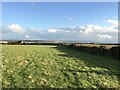
Farmland at Trewithick
Farmland at Trewithick Farm near Breage and Porthleven.
Image: © Ajay Tegala
Taken: 4 Nov 2021
0.19 miles
8
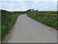
Beacon Road near Troon Tanner
Looking north-westward. This road links Porthleven with Rinsley croft.
Image: © Peter Wood
Taken: 30 Apr 2017
0.19 miles
9
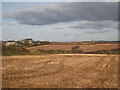
Field of stubble at Trewithick
In the distance can be seen the tower of Image
Image: © Rod Allday
Taken: 11 Dec 2012
0.20 miles
10
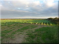
Field of greens at Trevallance Farm
I wasn't close-up enough to tell what sort of greens they are, but they'll either be for human consumption or for animal feed.
Image: © Richard Law
Taken: 14 Oct 2015
0.21 miles