
IMAGES TAKEN NEAR TO
St. Peters Way, HELSTON, TR13 9AZ
Introduction
This page details the photographs taken nearby to St. Peters Way, TR13 9AZ by members of the Geograph project.
The Geograph project started in 2005 with the aim of publishing, organising and preserving representative images for every square kilometre of Great Britain, Ireland and the Isle of Man.

There are currently over 7.5m images from over14,400 individuals and you can help contribute to the project by visiting https://www.geograph.org.uk
Image Map
Images are licensed for reuse under creativecommons.org/licenses/by-sa/2.0
Notes
- Clicking on the map will re-center to the selected point.
- The higher the marker number, the further away the image location is from the centre of the postcode.
Image Listing (278 Images Found)
Images are licensed for reuse under creativecommons.org/licenses/by-sa/2.0
Image
Details
Distance
2
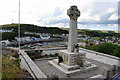
War memorial at Porthleven
It is situated slightly away from the busiest areas but in a position overlooking the harbour.
Image: © Bill Boaden
Taken: 7 Jul 2014
0.10 miles
3
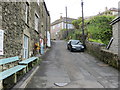
Salt Cellar Road in Porthleven
Looking eastward.
Image: © Peter Wood
Taken: 30 Apr 2017
0.10 miles
4
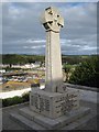
Porthleven war memorial
Porthleven war memorial stands on the side of Peverell Terrace overlooking the sea and the harbour below. Here it is pictured early on a late September morning with the low sun not yet fully lighting the cross.
Image: © Philip Halling
Taken: 26 Sep 2010
0.10 miles
5
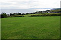
Horseshoe Playing Field
Recreational green space above Porthleven. The football pitch is on a slope which could prove challenging.
Image: © Bill Boaden
Taken: 7 Jul 2014
0.10 miles
6
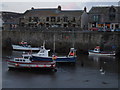
Porthleven Harbour at dusk
Taken at 8.30pm, just as the harbour lights came on.
Image: © Sharon Palmer
Taken: 13 Aug 2008
0.11 miles
7
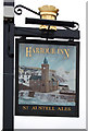
Pub sign, Harbour Inn, Porthleven
The sign outside the Harbour Inn on the quay at Porthleven shows a wave heading ominously close to the Bickford-Smith Institute, at the Gravesend area of the town. Gravesend was so named because shipwrecked sailors who drowned off the coast here were often buried along the cliffside to the east of here.
Image: © Mari Buckley
Taken: 18 Oct 2005
0.11 miles
8
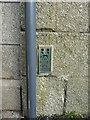
OS Flush Bracket - Porthleven
Flush Bracket S1476, set into the wall of the Customs House Art Gallery, which as the name implies was originally the local Customs House, and also the Harbour Master's house. The bracket was levelled in 1972 at 6.833m above Ordnance Datum Newlyn.
Image: © Richard Law
Taken: 13 Oct 2015
0.11 miles
10
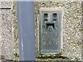
Ordnance Survey Flush Bracket S1476
This bracket can be found on the roadside wall of the Old Customs House. The benchmark height is recorded as being 6.833 metres above sea level.
For more detail see : http://www.bench-marks.org.uk/bm11687
Image: © Peter Wood
Taken: 30 Apr 2017
0.12 miles