
IMAGES TAKEN NEAR TO
Meneage Street, HELSTON, TR13 8RE
Introduction
This page details the photographs taken nearby to Meneage Street, TR13 8RE by members of the Geograph project.
The Geograph project started in 2005 with the aim of publishing, organising and preserving representative images for every square kilometre of Great Britain, Ireland and the Isle of Man.

There are currently over 7.5m images from over14,400 individuals and you can help contribute to the project by visiting https://www.geograph.org.uk
Image Map
Images are licensed for reuse under creativecommons.org/licenses/by-sa/2.0
Notes
- Clicking on the map will re-center to the selected point.
- The higher the marker number, the further away the image location is from the centre of the postcode.
Image Listing (114 Images Found)
Images are licensed for reuse under creativecommons.org/licenses/by-sa/2.0
Image
Details
Distance
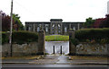
2
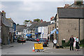
Helston: Meneage Street 5
At its junction with The Parade. Meneage Street is one-way for traffic
Image: © Martin Bodman
Taken: 24 Sep 2008
0.06 miles
3
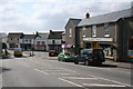
Helston: The Parade
Looking west-south-west towards Meneage Street
Image: © Martin Bodman
Taken: 24 Sep 2008
0.06 miles
4
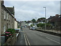
Meneage Street, Helston
Looking north west.
Image: © JThomas
Taken: 12 Jul 2017
0.07 miles
5
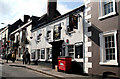
Helston: The 'Rodney Inn'
Meneage Street. Named, of course, for Admiral Lord Rodney, whose portrait is featured on the sign. Excellent St. Austell ales, and food available.
Image: © Dr Neil Clifton
Taken: 20 Apr 2010
0.08 miles
6

Decorated shop, Meneage Street, Helston
Decorated for the town's "Flora Day" Festival to welcome the arrival of spring
Image: © Derek Voller
Taken: 6 May 2016
0.08 miles
7
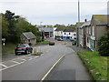
The Parade in Helston
Looking south-westward.
Image: © Peter Wood
Taken: 30 Apr 2017
0.08 miles
9
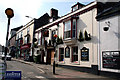
Helston: The 'Bell', Meneage Street
Image: © Dr Neil Clifton
Taken: 20 Apr 2010
0.08 miles
10
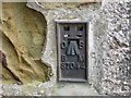
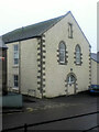
Ordnance Survey Flush Bracket S7044
This bracket can be found on the wall of the former Workhouse/Institute - now private dwellings - in Helston. The benchmark height is recorded as being 64.128 metres above sea level.
For more detail see : http://www.bench-marks.org.uk/bm19658
Image: © Peter Wood
Taken: 30 Apr 2017
0.08 miles