IMAGES TAKEN NEAR TO
Porkellis, HELSTON, TR13 0LE
Introduction
This page details the photographs taken nearby to TR13 0LE by members of the Geograph project.
The Geograph project started in 2005 with the aim of publishing, organising and preserving representative images for every square kilometre of Great Britain, Ireland and the Isle of Man.

There are currently over 7.5m images from over14,400 individuals and you can help contribute to the project by visiting https://www.geograph.org.uk
Image Map
Images are licensed for reuse under creativecommons.org/licenses/by-sa/2.0
Notes
- Clicking on the map will re-center to the selected point.
- The higher the marker number, the further away the image location is from the centre of the postcode.
Image Listing (8 Images Found)
Images are licensed for reuse under creativecommons.org/licenses/by-sa/2.0
Image
Details
Distance
1
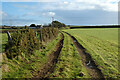
Track and pasture, Wendron
The footpath approaching Pollangreen Farm from the west.
Image: © Andrew Smith
Taken: 26 Dec 2022
0.08 miles
3
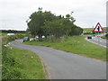
Cornwall The A394 Sweeping Through The Landscape
Image: © Roy Hughes
Taken: 25 Jun 2016
0.11 miles
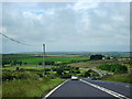
4
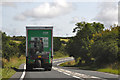
Cornwall : The A394
Heading along the A394 and following a lorry as it heads through Cornwall.
Image: © Lewis Clarke
Taken: 17 Jul 2015
0.19 miles
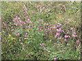
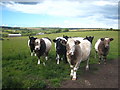
6

Pasture at Garlidna
The chimney on the horizon is this one: Image
Image: © Rod Allday
Taken: 9 Jun 2011
0.20 miles