
IMAGES TAKEN NEAR TO
Wendron, HELSTON, TR13 0JB
Introduction
This page details the photographs taken nearby to TR13 0JB by members of the Geograph project.
The Geograph project started in 2005 with the aim of publishing, organising and preserving representative images for every square kilometre of Great Britain, Ireland and the Isle of Man.

There are currently over 7.5m images from over14,400 individuals and you can help contribute to the project by visiting https://www.geograph.org.uk
Image Map
Images are licensed for reuse under creativecommons.org/licenses/by-sa/2.0
Notes
- Clicking on the map will re-center to the selected point.
- The higher the marker number, the further away the image location is from the centre of the postcode.
Image Listing (6 Images Found)
Images are licensed for reuse under creativecommons.org/licenses/by-sa/2.0
Image
Details
Distance
1
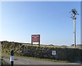
Sign and track for Higher Carthew Farm
Advertising self-catering barns
Image: © David Smith
Taken: 14 Mar 2016
0.14 miles
2
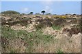
Heathland
This area of heathland is sat in a triangle between roads near Nine Maidens Down.
Image: © Tony Atkin
Taken: 27 Apr 2006
0.18 miles
3
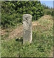
Old Boundary Marker just off the B3280, Carn Brea
Mine Boundary Marker on the northeast side of a minor road between the B3280 and B3297, 14 metres from its junction with the B3280. Carn Brea parish. Inscribed S, facing west, and L, facing east.
Milestone Society National ID: CW_CARNB18em
Image: © P Barnett
Taken: 25 Jun 2024
0.20 miles
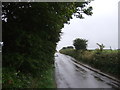
6
Looking north east on the B3280
Towards Redruth.
Image: © JThomas
Taken: 11 Jul 2017
0.22 miles