
IMAGES TAKEN NEAR TO
Longstone Downs, HELSTON, TR13 0HF
Introduction
This page details the photographs taken nearby to Longstone Downs, TR13 0HF by members of the Geograph project.
The Geograph project started in 2005 with the aim of publishing, organising and preserving representative images for every square kilometre of Great Britain, Ireland and the Isle of Man.

There are currently over 7.5m images from over14,400 individuals and you can help contribute to the project by visiting https://www.geograph.org.uk
Image Map
Images are licensed for reuse under creativecommons.org/licenses/by-sa/2.0
Notes
- Clicking on the map will re-center to the selected point.
- The higher the marker number, the further away the image location is from the centre of the postcode.
Image Listing (6 Images Found)
Images are licensed for reuse under creativecommons.org/licenses/by-sa/2.0
Image
Details
Distance
1
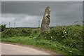
The Prospidnick Long Stone
This is a 3 metre high standing stone on Longstone Down, 660 metres northeast of Prospidnick Hill. It is probably ancient.
Image: © Tony Atkin
Taken: 20 May 2006
0.07 miles
2
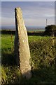
The Prospidnick menhir
This Bronze Age standing stone is in a hedge alongside a bend in a small country lane. Like many such menhirs, it is known locally as "The Long Stone". The dip in the coast in the distance is around Loe Bar/Porthleven.
Image: © Jim Champion
Taken: 11 Aug 2007
0.08 miles
3
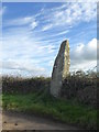
The Longstone standing stone on Trannack Hill
Standing approximately 12 feet high, this granite monolith is a Scheduled Monument thought to mark the burial site of a Celtic Chieftain.
Image: © Rod Allday
Taken: 16 Nov 2017
0.08 miles
5
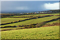
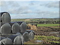
Pasture, Sithney
High Park Farm is seen in the middle distance with a showery skyline and the higher ground near St Ives beyond.
Image: © Andrew Smith
Taken: 26 Dec 2022
0.14 miles
6
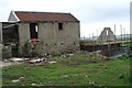
Rebuilding a Barn
Rebuilding of farm buildings is a common sight here. Often this is being done to convert a barn to tourist accommodation as a valuable extra source of income for the farmer.
Image: © Tony Atkin
Taken: 20 May 2006
0.15 miles