IMAGES TAKEN NEAR TO
Redannick Crescent, TRURO, TR1 2DQ
Introduction
This page details the photographs taken nearby to Redannick Crescent, TR1 2DQ by members of the Geograph project.
The Geograph project started in 2005 with the aim of publishing, organising and preserving representative images for every square kilometre of Great Britain, Ireland and the Isle of Man.

There are currently over 7.5m images from over14,400 individuals and you can help contribute to the project by visiting https://www.geograph.org.uk
Image Map
Images are licensed for reuse under creativecommons.org/licenses/by-sa/2.0
Notes
- Clicking on the map will re-center to the selected point.
- The higher the marker number, the further away the image location is from the centre of the postcode.
Image Listing (34 Images Found)
Images are licensed for reuse under creativecommons.org/licenses/by-sa/2.0
Image
Details
Distance
1

Allotments in Redannick Lane
With a fine view over the city of Truro and its cathedral.
Image: © Rod Allday
Taken: 22 May 2010
0.04 miles
2
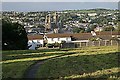
Truro. Treyew Road viewpoint
A space has been left in the building line to allow this view over the city.
For an older view see http://www.oldukphotos.com/graphics/England%20Photos/Cornwall,%20Truro,%20Cathedral%20City%201960%27s.jpg
Image: © Fred James
Taken: 22 Jun 2008
0.05 miles
3
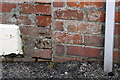
Benchmark on #27 Daniell Road (Redannick Lane face)
Ordnance Survey cut mark benchmark described on the Bench Mark Database at http://www.bench-marks.org.uk/bm40201
Image: © Roger Templeman
Taken: 12 Nov 2011
0.09 miles
4
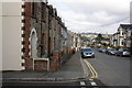
Daniell Road at its Redannick Lane junction
At the junction of the house and its front side wall is an OS benchmark Image
Image: © Roger Templeman
Taken: 12 Nov 2011
0.09 miles
5
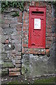
Benchmark at entrance to #56 Daniell Road
The Ordnance Survey cut mark benchmark is described on the Bench Mark Database at http://www.bench-marks.org.uk/bm40186
Image: © Roger Templeman
Taken: 12 Nov 2011
0.10 miles
6
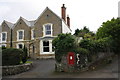
#56 Daniell Road and a GR letter box
On the wall to the left of the letter box is an OS benchmark Image
Image: © Roger Templeman
Taken: 12 Nov 2011
0.10 miles
7
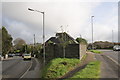
Walls at junction of Green Lane and Daniell Road
On the corner of the wall on the sunlit face is an OS benchmark Image
Image: © Roger Templeman
Taken: 12 Nov 2011
0.15 miles
8
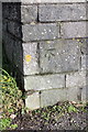
Benchmark on the wall of Green Lane
Ordnance Survey cut mark benchmark described on the Bench Mark Database at http://www.bench-marks.org.uk/bm40185
Image: © Roger Templeman
Taken: 12 Nov 2011
0.15 miles
9

Viewpoint on Treyew Road Truro
This small patch of green between the houses affords a fine view over the city, with the imposing bulk of the cathedral in the centre.
Image: © Rod Allday
Taken: 26 Feb 2010
0.16 miles