
IMAGES TAKEN NEAR TO
Penmenner Road, HELSTON, TR12 7NR
Introduction
This page details the photographs taken nearby to Penmenner Road, TR12 7NR by members of the Geograph project.
The Geograph project started in 2005 with the aim of publishing, organising and preserving representative images for every square kilometre of Great Britain, Ireland and the Isle of Man.

There are currently over 7.5m images from over14,400 individuals and you can help contribute to the project by visiting https://www.geograph.org.uk
Image Map
Images are licensed for reuse under creativecommons.org/licenses/by-sa/2.0
Notes
- Clicking on the map will re-center to the selected point.
- The higher the marker number, the further away the image location is from the centre of the postcode.
Image Listing (26 Images Found)
Images are licensed for reuse under creativecommons.org/licenses/by-sa/2.0
Image
Details
Distance
1
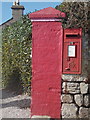
The Lizard: postbox № TR12 41, Penmenner Road
This Elizabeth II-reign postbox is the most southerly box on mainland Britain and is set into a wall at the end of Penmenner Road. Next to it is a guest house whose gateposts are painted extremely bright pink.
Image: © Chris Downer
Taken: 17 Oct 2013
0.01 miles
2
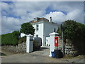
B&B on Penmenner Road, Lizard
Showing position of Postbox No. TR12 82.
See Image] for postbox.
Image: © JThomas
Taken: 12 Jul 2017
0.01 miles
3
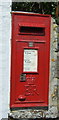
Elizabeth II postbox on Penmenner Road, Lizard
Postbox No. TR12 82.
See Image] for context.
Image: © JThomas
Taken: 12 Jul 2017
0.02 miles
4
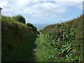
Track (bridleway), Lizard Peninsula
Heads south west towards the coastal path.
Image: © JThomas
Taken: 12 Jul 2017
0.08 miles
5
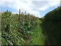
Bridleway towards Lizard
Looking north east.
Image: © JThomas
Taken: 12 Jul 2017
0.08 miles
7
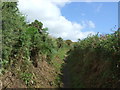
Track (bridleway) towards Lizard
From Polpeor Cliff.
Image: © JThomas
Taken: 12 Jul 2017
0.13 miles
8

Field and path south of Lizard
The path on the right leads up from the Lizard headland towards the village - installed by the National Trust as a direct wheelchair- and buggy-friendly route from the parking at Lizard village, avoiding the need to walk down the narrow lane.
Image: © Jim Champion
Taken: 26 Aug 2006
0.14 miles
9

Footpath to Lizard
The path keeps people off the lane which runs parallel. The village ahead looks completely flat, but it is on a plateau about 75 metres above sea level.
Image: © Bill Boaden
Taken: 2 Jul 2014
0.17 miles
10
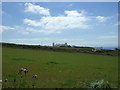
Grazing, Lizard
View towards Lizard Lighthouse.
Image: © JThomas
Taken: 12 Jul 2017
0.17 miles