IMAGES TAKEN NEAR TO
Park Enskellaw, HELSTON, TR12 7JG
Introduction
This page details the photographs taken nearby to Park Enskellaw, TR12 7JG by members of the Geograph project.
The Geograph project started in 2005 with the aim of publishing, organising and preserving representative images for every square kilometre of Great Britain, Ireland and the Isle of Man.

There are currently over 7.5m images from over14,400 individuals and you can help contribute to the project by visiting https://www.geograph.org.uk
Image Map
Images are licensed for reuse under creativecommons.org/licenses/by-sa/2.0
Notes
- Clicking on the map will re-center to the selected point.
- The higher the marker number, the further away the image location is from the centre of the postcode.
Image Listing (22 Images Found)
Images are licensed for reuse under creativecommons.org/licenses/by-sa/2.0
Image
Details
Distance

2
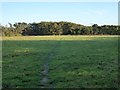
Footpath across the fields from Angrouse to Mullion
Image: © David Smith
Taken: 29 Sep 2015
0.05 miles
3
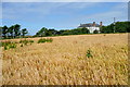
Towards Angrouse Farm
We had started, only 10 minuts earlier, in rain, but the sun came out quickly after the rain stopped and the barley here was glistening. At the far end of this footpath, near Angrouse Farm, John Wesley preached a sermon on 7th September 1762. There is a stone marking the location, which is a listed structure.
Image: © Graham Horn
Taken: 5 Jul 2011
0.07 miles
4

House and Barns, Laflouder Lane
Laflouder Lane winds its way past houses on the west side of Mullion and ends up as a track down to the sea.
Image: © Des Blenkinsopp
Taken: 27 Sep 2020
0.11 miles
6

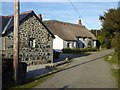
Junction of tracks in the Meres, Mullion
That on the left is marked as a footpath
Image: © David Smith
Taken: 29 Sep 2015
0.11 miles
7
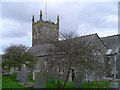
The Church of St Mellanus Mullion
The Beautiful 13th century church in Mullion is well worth a visit.
Image: © Jim Dugdale
Taken: 16 Apr 2005
0.13 miles
8

Laflouder Lane, Mullion
Laflouder Lane winds its way past houses on the west side of Mullion and ends up as a track down to the sea.
Image: © Des Blenkinsopp
Taken: 27 Sep 2020
0.13 miles