
IMAGES TAKEN NEAR TO
Harmony Terrace, TRURO, TR1 1QT
Introduction
This page details the photographs taken nearby to Harmony Terrace, TR1 1QT by members of the Geograph project.
The Geograph project started in 2005 with the aim of publishing, organising and preserving representative images for every square kilometre of Great Britain, Ireland and the Isle of Man.

There are currently over 7.5m images from over14,400 individuals and you can help contribute to the project by visiting https://www.geograph.org.uk
Image Map
Images are licensed for reuse under creativecommons.org/licenses/by-sa/2.0
Notes
- Clicking on the map will re-center to the selected point.
- The higher the marker number, the further away the image location is from the centre of the postcode.
Image Listing (19 Images Found)
Images are licensed for reuse under creativecommons.org/licenses/by-sa/2.0
Image
Details
Distance
2
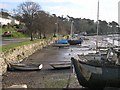
Boats Moored on the Truro River
On the eastern bank of the river just north of Boscawen Park at low tide.
Image: © Tony Atkin
Taken: 2 Jan 2006
0.07 miles

4
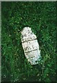
Old Milestone by Malpas Road, south of Truro
Carved stone post by the UC road, in parish of TRURO (CARRICK District), Malpas Road, just North of Trennick Mill, leaning against bank, on outside of bend, on East side of road. Truro stone, erected by the Truro turnpike trust in the 18th century.
Inscription reads:-
FROM
TRURO
1
MILE
Grade II Listed. List Entry Number:1205797
https://historicengland.org.uk/listing/the-list/list-entry/1205797
Milestone Society National ID: CW_TOMA01.
Image: © Ian Thompson
Taken: 1 Jun 2004
0.08 miles
5
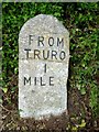
Old Milestone by Malpas Road, south of Truro
Carved stone post by the UC road, in parish of TRURO (CARRICK District), Malpas Road, just North of Trennick Mill, leaning against bank, on outside of bend, on East side of road. Truro stone, erected by the Truro turnpike trust in the 18th century.
Inscription reads:-
FROM
TRURO
1
MILE
Grade II listed.
List Entry Number: 1205797 https://historicengland.org.uk/listing/the-list/list-entry/1205797
Milestone Society National ID: CW_TOMA01
Image: © Rosy Hanns
Taken: 19 May 2019
0.08 miles
6
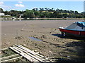
Truro River
Looking across the river from a small slipway on Newham Road. On the far side is Boscawen Park, beyond which trees follow the hedges alongside narrow fields across the hill below Little Park Farm.
Image: © Derek Harper
Taken: 6 Sep 2007
0.10 miles
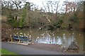
8
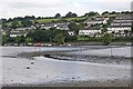
Truro River at low tide
The twisting course of the channel up the Truro river is marked by the port (red) and starboard (green) hand markers. The mudbanks are constantly shifting, however, so a mark can quickly become out of position and outside the channel there is very little depth of water even at high tide. Trying to reach the head of the river other than at the very top of the tide is hazardous.
Image: © Graham Loveland
Taken: 27 Aug 2010
0.12 miles
9
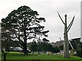
Boscawen Park
This park was built on an area of reclaimed marshland in the Truro Estuary
Image: © Tony Atkin
Taken: 2 Jan 2006
0.16 miles
10
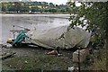
Abandoned (?) boat by Truro river
This stretch of water is home to a number of apparently abandoned boats, though the presence of a cover possibly suggests this one is not yet totally abandoned. Wind, weather, and the damp salty atmosphere can result in very rapid deterioration.
Image: © Graham Loveland
Taken: 27 Aug 2010
0.17 miles