
IMAGES TAKEN NEAR TO
Mitchell Hill Terrace, TRURO, TR1 1HY
Introduction
This page details the photographs taken nearby to Mitchell Hill Terrace, TR1 1HY by members of the Geograph project.
The Geograph project started in 2005 with the aim of publishing, organising and preserving representative images for every square kilometre of Great Britain, Ireland and the Isle of Man.

There are currently over 7.5m images from over14,400 individuals and you can help contribute to the project by visiting https://www.geograph.org.uk
Image Map
Images are licensed for reuse under creativecommons.org/licenses/by-sa/2.0
Notes
- Clicking on the map will re-center to the selected point.
- The higher the marker number, the further away the image location is from the centre of the postcode.
Image Listing (54 Images Found)
Images are licensed for reuse under creativecommons.org/licenses/by-sa/2.0
Image
Details
Distance
1
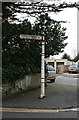
Old Direction Sign - Signpost by Bodmin Road
Pointed turban finial - 1 arm; Royal Label Factory by the UC road, in parish of Truro (Carrick District), Bodmin Road at junction with Mitchell Hill and Carvoza Road, on pavement.
To be surveyed
Milestone Society National ID: CW_SW8345
Image: © Alan Rosevear
Taken: 26 Feb 2009
0.09 miles
2
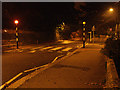
Orange street lighting & Belisha beacons
Night time urban street lighting reduces everything to one colour, as weather conditions can transform a place - compare Image
Image: © Camilla Comeau
Taken: 20 Sep 2003
0.10 miles
3
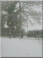
An increasingly rare sight in Cornwall
No cars! This normally busy junction was almost like being in the middle of the country again... for about an hour.
Image: © Camilla Comeau
Taken: 25 Nov 2005
0.10 miles
5
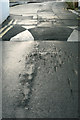
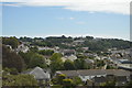
Speed hump, Campfield Hill
Note the damage to the tarmac and imagine the damage done to the cars... this speed hump is too high. I have entered it under "traffic calming measures" but it does nothing to calm the drivers.
Image: © Camilla Comeau
Taken: 17 Dec 2006
0.13 miles
6
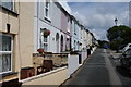
Paul's Row, Truro
A terraced row on a hillside above the city centre.
Image: © Bill Boaden
Taken: 28 Jun 2014
0.14 miles
7
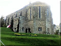
The former Convent of the Epiphany (1910) now Alverton Manor Hotel
Image: © Paul Barnett
Taken: 1 Jan 2017
0.16 miles
8
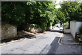
Agar Road, Truro
A residential road made quieter by being blocked off at the bottom.
Image: © Bill Boaden
Taken: 28 Jun 2014
0.17 miles
9
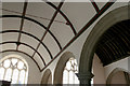
Barrel roof, south aisle of St Paul's Church Truro
This church is sadly now closed as it is in a dangerous condition.
Image: © Camilla Comeau
Taken: 27 Apr 2006
0.18 miles
10
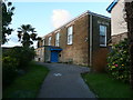
Friends' Meeting House, Paul's Terrace, Truro
This was built in 1825. It is listed, Grade II.
Image: © Humphrey Bolton
Taken: 7 Jan 2016
0.18 miles