IMAGES TAKEN NEAR TO
Kersey Close, FALMOUTH, TR11 5TS

Introduction

This page details the photographs taken nearby to Kersey Close, TR11 5TS by members of the Geograph project.

The Geograph project started in 2005 with the aim of publishing, organising and preserving representative images for every square kilometre of Great Britain, Ireland and the Isle of Man.

There are currently over 7.5m images from over14,400 individuals and you can help contribute to the project by visiting https://www.geograph.org.uk

Image Map


Images are licensed for reuse under creativecommons.org/licenses/by-sa/2.0
Notes
  • Clicking on the map will re-center to the selected point.
  • The higher the marker number, the further away the image location is from the centre of the postcode.

Image Listing (23 Images Found)

Images are licensed for reuse under creativecommons.org/licenses/by-sa/2.0
  • ...
Image
Details
Distance
1
Footpath to Tregew
Image: © Row17 Taken: 12 Aug 2008
0.03 miles
2
Houses on the edge of Flushing
Up the hill behind the 'pretty' houses near the harbour front are these practical semi detached houses. My guess is that this is where many of the local people actually live while the village centre is full of holidaymakers and incomers.
Image: © Tony Atkin Taken: 5 Jul 2006
0.07 miles
3
Flushing Methodist Church
Image: © Chris Allen Taken: 25 Sep 2008
0.11 miles
4
Trefusis Barton
View from the public footpath, walking from Flushing village, over the hills towards Mylor Boatyard. A grain field on a sunny day during lock down.
Image: © Oona Wiggan Taken: 1 Jun 2020
0.13 miles
5
Royal Standard pub, Flushing
Image: © Graham Loveland Taken: 8 Oct 2009
0.18 miles
6
Seven Stars, Flushing
Image: © Richard Rogerson Taken: 2 Jul 2015
0.19 miles
7
St Peter's Church, Flushing
Image: © Paul Barnett Taken: Unknown
0.19 miles
8
A church in Flushing
Image: © Row17 Taken: 12 Aug 2008
0.19 miles
9
St. Peter's C of E church, Flushing
Image: © Graham Loveland Taken: 8 Oct 2009
0.19 miles
10
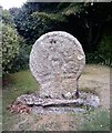
Old Wayside Cross - moved to Flushing churchyard, Mylor Parish
Flushing churchyard Cross, old head and neck, Langdon WC No. 76 by the off-road path, in parish of Mylor (Carrick District), Flushing churchyard. Grade II listed. List Entry Number: 1141613 https://historicengland.org.uk/listing/the-list/list-entry/1141613 To be surveyed Milestone Society National ID: CWCA_MYL01
Image: © Milestone Society Taken: Unknown
0.20 miles
  • ...