
IMAGES TAKEN NEAR TO
High Cross, FALMOUTH, TR11 5RF
Introduction
This page details the photographs taken nearby to High Cross, TR11 5RF by members of the Geograph project.
The Geograph project started in 2005 with the aim of publishing, organising and preserving representative images for every square kilometre of Great Britain, Ireland and the Isle of Man.

There are currently over 7.5m images from over14,400 individuals and you can help contribute to the project by visiting https://www.geograph.org.uk
Image Map
Images are licensed for reuse under creativecommons.org/licenses/by-sa/2.0
Notes
- Clicking on the map will re-center to the selected point.
- The higher the marker number, the further away the image location is from the centre of the postcode.
Image Listing (8 Images Found)
Images are licensed for reuse under creativecommons.org/licenses/by-sa/2.0
Image
Details
Distance
2
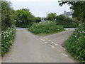
Junction of roads near High Cross
Looking north-eastward.
Image: © Peter Wood
Taken: 4 May 2017
0.04 miles
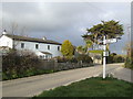
4
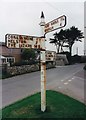
Direction Sign ? Signpost
Located on a grass triangle in the centre of the Y junction at High Cross in Constantine parish. 3 arms and spear finial. https://www.geograph.org.uk/photo/371044 shows how it looked in 2007 and https://www.geograph.org.uk/photo/6047805 without arms and finial in 2014.
Milestone Society National ID: CW_SW7429
Image: © W Marsh
Taken: Unknown
0.04 miles
5
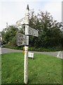
Direction Sign ? Signpost
Located on a grass triangle in the centre of the Y junction at High Cross in Constantine parish. 3 arms and spear finial. https://www.geograph.org.uk/photo/6593359 shows it in 1999, https://www.geograph.org.uk/photo/371044 in 2007 and https://www.geograph.org.uk/photo/6047805 in 2014 without arms and finial. This was one of a small number of fingerposts targeted by Cornwall Council for refurbishment a few years ago. It looks as if they took it away and decided it didn't need anything doing to it.
Milestone Society National ID: CW_SW7429
Image: © I Thompson
Taken: 8 Sep 2020
0.04 miles
6

Old Direction Sign - Signpost by High Cross
Finial - by the UC road, in parish of Constantine (Kerrier District), High Cross.
Cornwall & Scilly HER listed.
HER Number: MCO55771 https://www.heritagegateway.org.uk/Gateway/Results_Single.aspx?uid=MCO55771&resourceID=1020
To be surveyed
Milestone Society National ID: CW_SW7429
Image: © Milestone Society
Taken: Unknown
0.05 miles
8

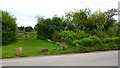
Farmland, Constantine
Daffodil bulbs had been lifted and were drying in a field crossed by two footpaths to the east of High Cross.
Image: © Andrew Smith
Taken: 2 Jun 2022
0.15 miles