IMAGES TAKEN NEAR TO
Nangitha Terrace, FALMOUTH, TR11 5DQ

Introduction

This page details the photographs taken nearby to Nangitha Terrace, TR11 5DQ by members of the Geograph project.

The Geograph project started in 2005 with the aim of publishing, organising and preserving representative images for every square kilometre of Great Britain, Ireland and the Isle of Man.

There are currently over 7.5m images from over14,400 individuals and you can help contribute to the project by visiting https://www.geograph.org.uk

Image Map


Images are licensed for reuse under creativecommons.org/licenses/by-sa/2.0
Notes
  • Clicking on the map will re-center to the selected point.
  • The higher the marker number, the further away the image location is from the centre of the postcode.

Image Listing (19 Images Found)

Images are licensed for reuse under creativecommons.org/licenses/by-sa/2.0
Image
Details
Distance
1
Budock Water, Vicarage Hill
Approaching Budock Water via Vicarage Hill.
Image: © David Dixon Taken: 1 Aug 2010
0.08 miles
2
Falmouth Meadery, School Hill, Budock Water
Open on evenings for a medieval experience children welcome. See Merlin the wizard at Image
Image: © Steve Fareham Taken: 15 Oct 2013
0.08 miles
3
Budock Water, School Hill
Looking down the hill, into the village.
Image: © David Dixon Taken: 1 Aug 2010
0.08 miles
4
King Arthur's Meadery
On School Hill, Budock Water
Image: © David Dixon Taken: 1 Aug 2010
0.10 miles
5
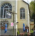
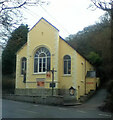
The Sanctuary
Bar and grill housed in a former chapel.
Image: © N Chadwick Taken: 28 Apr 2018
0.10 miles
6
Wesley
Image: © Paul Barnett Taken: 27 Dec 2014
0.10 miles
7
Roadside culvert
Image: © N Chadwick Taken: 28 Apr 2018
0.11 miles
8
Merlin at Falmouth Meadery
see Image
Image: © Steve Fareham Taken: 15 Oct 2013
0.11 miles
9
Buddock Village Hall
Image: © N Chadwick Taken: 28 Apr 2018
0.14 miles
10
Pasture at Nangitha Farm
St Budock church in the distance and St Anthony lighthouse on the far horizon.
Image: © Rod Allday Taken: 1 Jun 2008
0.17 miles