
IMAGES TAKEN NEAR TO
Melvill Lane, FALMOUTH, TR11 4DY
Introduction
This page details the photographs taken nearby to Melvill Lane, TR11 4DY by members of the Geograph project.
The Geograph project started in 2005 with the aim of publishing, organising and preserving representative images for every square kilometre of Great Britain, Ireland and the Isle of Man.

There are currently over 7.5m images from over14,400 individuals and you can help contribute to the project by visiting https://www.geograph.org.uk
Image Map
Images are licensed for reuse under creativecommons.org/licenses/by-sa/2.0
Notes
- Clicking on the map will re-center to the selected point.
- The higher the marker number, the further away the image location is from the centre of the postcode.
Image Listing (165 Images Found)
Images are licensed for reuse under creativecommons.org/licenses/by-sa/2.0
Image
Details
Distance
1
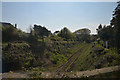
Falmouth : Railway Line
A railway heading through Falmouth.
Image: © Lewis Clarke
Taken: 19 Apr 2017
0.02 miles
2
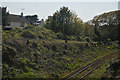
Falmouth : Railway Line
From the bridge looking down to the railway.
Image: © Lewis Clarke
Taken: 19 Apr 2017
0.05 miles
3
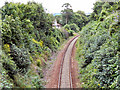
Falmouth Branch Line
The single track railway branch line from Truro to Falmouth, just after it passes under the bridge at Melvill Road.
Image: © David Dixon
Taken: 27 Jul 2010
0.05 miles
4
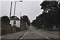
Falmouth : Melvill Road
Looking along the road which heads out of Falmouth.
Image: © Lewis Clarke
Taken: 13 Jul 2015
0.06 miles
5
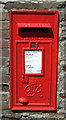
George VI postbox on Melvill Road, Falmouth
Postbox No. TR11 21.
See Image] for context.
Image: © JThomas
Taken: 12 Jul 2017
0.06 miles
6
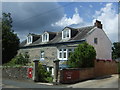
House on Melvill Road, Falmouth
Showing position of Postbox No. TR11 21.
See Image] for postbox.
Image: © JThomas
Taken: 12 Jul 2017
0.06 miles

8
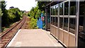
Falmouth Town station platform and shelter
Looking along the track on the up line to Truro.
Image: © AlastairG
Taken: 2 Jul 2014
0.11 miles

10

Falmouth Town Station
This station was not built with the original railway line which terminated, as it still does, about 800 metres down the line at Falmouth Docks Image It appears that it was created on the railway embankment at this point when the line was turned into a single track line in 1970. For a while it was the last station on the line until the original Falmouth station was reopened in 1975 as Falmouth Docks.
Image: © Tony Atkin
Taken: 1 May 2006
0.11 miles