1
House at road junction south of Antron
There are two minor roads branching to the left off the main road, which takes a sharp turn by the house, so the overall effect is of a crossroads
Image: © David Smith
Taken: 30 Sep 2015
0.03 miles
2
Old Direction Sign - Signpost by Church Road, Antron, Mabe parish
Onion finial - arm 1 is a replacement with square end; Visick casting by the UC road, in parish of Mabe (Carrick District), South of Antron at Mabe Church turn, on grass corner by wide entrance to field.
Cornwall & Scilly HER.
HER Number: MCO55774. https://www.heritagegateway.org.uk/Gateway/Results_Single.aspx?uid=MCO55774&resourceID=1020
Surveyed
Milestone Society National ID: CW_SW7633
Image: © Milestone Society
Taken: Unknown
0.03 miles
3
Church road west of Antron Farm
Image: © Stuart Logan
Taken: 13 Oct 2012
0.06 miles
4
Houses Near Antron
A line of houses along a country lane.
Image: © Tony Atkin
Taken: 1 May 2006
0.10 miles
5
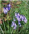
Bluebell - Hyacinthoides non-scriptus
As well as being a plant famous for bringing a carpet of colour to woodland floors in the spring, bluebells are also a common roadside plant in Cornwall. These ones were seen on the verge just north of Antron.
Image: © Tony Atkin
Taken: 1 May 2006
0.15 miles
6
Sunshine on Antron Farm
Image: © Rod Allday
Taken: 1 Dec 2012
0.16 miles
7
Falmouth, Carrick Roads, and Roseland Peninsula from near Trenoweth Lane
View looking south east over fields towards Falmouth, the ria of Carrick Roads, the Roseland Peninsula, and then to the sea beyond.
Image: © Graham Loveland
Taken: 7 Jan 2009
0.17 miles
8
Daffodils growing wild
Early March 2009, clumps of daffodils growing, apparently wild, in a field used, in rotation with others locally, for cattle grazing. Who planted them? Good job the cows are not in this field currently or they'd have eaten them!
In far background is the ria of Carrick Roads with the Roseland peninsla beyond.
Image: © Graham Loveland
Taken: 13 Mar 2009
0.22 miles
9
Reseeding grazing land
Used for occasional grazing of cattle, the grass in these fields was apparently seven years old and it was time for reseeding. The process consisted of first ploughing up and turning over the old grass, then shallow raking of the surface to even it up, before rolling with a massive water-filled roller, and then finally reseeding as pictured here. Then sit back and hope for rain to make it all grow.
Image: © Graham Loveland
Taken: 31 Mar 2009
0.22 miles
10
Cornish Hedge
Although conventional bush hedges do exist in Cornwall, fields are more commonly demarcated by "Cornish Hedges", effectively a dry stone wall but composed of substantial, indeed often massive, blocks of granite cleared from the nearby fields. This one is relatively unusual in not being covered in earth and vegetation.
Image: © Graham Loveland
Taken: 13 Mar 2009
0.23 miles


