1
Rame : The A394
Looking along the A394 as it heads near to Rame.
Image: © Lewis Clarke
Taken: 17 Jul 2015
0.02 miles
2
Rame Post Office and general store
A wedge-shaped building by the A394 Penryn to Helston road.
Image: © Jonathan Billinger
Taken: 13 Mar 2007
0.10 miles
3
Cornwall : The A394
Heading through Cornwall on the A394.
Image: © Lewis Clarke
Taken: 17 Jul 2015
0.11 miles
4
Wayside cross
Image: © Paul Barnett
Taken: 18 Jan 2023
0.12 miles
5
Old Guide Stone by the A394, Rame Cross, Wendron parish
Carved guide stone by the A394, in parish of Wendron (Kerrier District), Rame Cross, in pavement.
Inscription reads:-
: TO / STITHIAN / GWENNAP / REDRUTH : : TO / PENRYN / TH / FALMOU / TRURO :
Grade II listed.
List Entry Number: 1141997 https://historicengland.org.uk/listing/the-list/list-entry/1141997
Surveyed
Milestone Society National ID: CW_XWEND
Image: © Milestone Society
Taken: Unknown
0.13 miles
6
Old Guide Stone by the A394 at Rame Cross, Wendron parish
Carved guide stone by the A394, in parish of Wendron (Kerrier District), Rame Cross, in pavement.
Inscription reads:-
: TO / STITHIAN / GWENNAP / REDRUTH : : TO / PENRYN / TH / FALMOU / TRURO :
Grade II listed.
List Entry Number: 1141997 https://historicengland.org.uk/listing/the-list/list-entry/1141997
Surveyed
Milestone Society National ID: CW_XWEND
Image: © Rosy Hanns
Taken: 20 Jul 2019
0.13 miles
7
Road Junction by Little Rame Farm
Image: © Tony Atkin
Taken: 28 Jun 2006
0.13 miles
8
Old Guide Stone by A394, Rame Cross
The Guide Stone is located in pavement on the North of the road. Parish of Wendron (Kerrier District). Carved stone post, Helston facets design, erected by the Helston turnpike trust in the 19th Century, edge chips. An earlier photograph can be found here: https://www.geograph.org.uk/photo/6061353
Inscription reads:-
TO / S / STITHIAN / GWENNAP / REDRUTH : : TO / PENRYN / TH / FALMOU / TRURO
Grade II listed. List Entry Number: 1141997 https://historicengland.org.uk/listing/the-list/list-entry/1141997
Milestone Society National ID: CW_XWEND
Image: © Paul Barnett
Taken: 21 Jun 2023
0.13 miles
9
Approaching Rame Village A394
Image: © Roy Hughes
Taken: 25 Jun 2016
0.13 miles
10
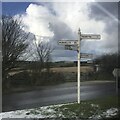
Fingerpost
Milestone Society National ID: CW_SW7234
Image: © Paul Barnett
Taken: 18 Jan 2023
0.13 miles


