
IMAGES TAKEN NEAR TO
Herniss, PENRYN, TR10 9DU
Introduction
This page details the photographs taken nearby to TR10 9DU by members of the Geograph project.
The Geograph project started in 2005 with the aim of publishing, organising and preserving representative images for every square kilometre of Great Britain, Ireland and the Isle of Man.

There are currently over 7.5m images from over14,400 individuals and you can help contribute to the project by visiting https://www.geograph.org.uk
Image Map
Images are licensed for reuse under creativecommons.org/licenses/by-sa/2.0
Notes
- Clicking on the map will re-center to the selected point.
- The higher the marker number, the further away the image location is from the centre of the postcode.
Image Listing (12 Images Found)
Images are licensed for reuse under creativecommons.org/licenses/by-sa/2.0
Image
Details
Distance
1
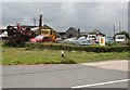
Something to do with Cars
This establishment looks like one of those all-purpose place which does anything to cars except build new ones. My thanks to a correspondent with local knowledge who tells me that this place used to be a stonemasons where granite, quarried from nearby Rosemanowas Image was dressed into building and ornamental masonry.
Image: © Tony Atkin
Taken: 28 Jun 2006
0.05 miles
4
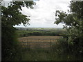
Field of hay at Rosemanowas Farm
The village of Stithians can be seen in the distance.
Image: © Rod Allday
Taken: 2 Jul 2008
0.12 miles
5
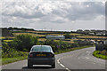
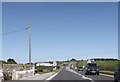
Cornwall : The A394
Heading through Cornwall on the A394.
Image: © Lewis Clarke
Taken: 17 Jul 2015
0.12 miles
6
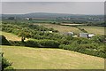
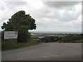
Rosemanowas Quarry
This area of the Carnmenellis granite uplands has been extensively quarried in the past. The trees and buildings beyond the field mark the position of the Rosemanowas Quarry which was, in the 1980's, the site of 'The Hot Dry Rocks Project' an experiment to derive power from the heat of the granite deep underground by drilling deep into the granite and pumping water through it to return very hot water to the surface to generate power. This form of energy generation has not yet been successful in the UK. I am told that during the Second World War this quarry was used as a dump by American forces stationed nearby. Local boys would scavenge live 303 ammunition from the dump, pull out the bullets and use the cordite to make bangers.
Image: © Tony Atkin
Taken: 28 Jun 2006
0.19 miles
8
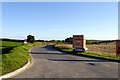
Access road for Struthal Farm
A minor road off the A394 near Rame leads to a farm and a machinery business
Image: © David Smith
Taken: 28 Sep 2015
0.21 miles
9
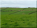
Pastures in early spring
The green-up in southern Cornwall is well advanced by St. Piran's Day.
The village in the distance is Rame.
Image: © Jonathan Billinger
Taken: 5 Mar 2008
0.21 miles
10
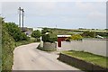
Backroad Scene
With scattered houses and gardens, powerlines and the main road beyond. Nothing unusual here, a quite typical backroad scene.
Image: © Tony Atkin
Taken: 28 Jun 2006
0.21 miles