1
The Old Library
Former library, Penryn.
Image: © Wayland Smith
Taken: 16 Jul 2016
0.03 miles
2
A traditional Punch and Judy show on Penryn Town Fair Day
Image: © Rod Allday
Taken: 26 Aug 2023
0.04 miles
3
Memorial, Quay Hill
This memorial and its garden, on Quay Hill, commemorate the 18 residents of Penryn who were killed during an air raid in May 1941. 23 homes were destroyed in the raid; the garden marks the spot where five of them stood before the bombing.
Image: © David Dixon
Taken: 30 Jul 2010
0.04 miles
4
Memorial Garden
This memorial and its garden, on Quay Hill, commemorate the 18 residents of Penryn who were killed during an air raid in May 1941. 23 homes were destroyed in the raid; the garden marks the spot where five of them stood before the bombing.
Image: © David Dixon
Taken: 30 Jul 2010
0.04 miles
5
Commercial road
Image: © Colin Pyle
Taken: 9 Apr 2010
0.06 miles
6
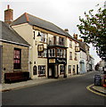
Kings Arms Hotel, Broad Street, Penryn
Bar & restaurant, with bed & breakfast accommodation available.
Image: © Jaggery
Taken: 16 Oct 2015
0.06 miles
7
Kings Arms
650 year old pub/hotel on Broad Street. Grade II listed since 1971 (http://www.britishlistedbuildings.co.uk/en-365719-the-kings-arms-hotel-penryn/osmap)
Image: © David Dixon
Taken: 30 Jul 2010
0.06 miles
8
King's Arms Hotel, 3 Broad Street, Penryn
Grade II Listed 17th century public house refronted mid 19th century. The Hotels website claims that the building dates back at least 650-700 years to around 1350. Prior to being an Inn it was the home of Benjamin Coode, a surgeon and Edward Coode, also a surgeon and apothecary. A King's Arms Hotel is first referenced in 1489 when many of King Henry VII's party stayed whilst en route to fetch Katherine of Aragon to marry his son. A former coaching inn, Disraeli reportedly stayed here between 1817 and 1831. Directory entries include; 1830-1852 John Powell; 1856 Mrs Jane Powell; 1873-1914 Arthur George Chapman, wine & spirit merchant. brewer, maltster & hop merchant; the most direct route for posting to the Lizard, Kynance Cove & other places of interest, posting- in all its branches.
Image: © Jo and Steve Turner
Taken: 30 Jun 2019
0.06 miles
9
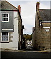
Between Lower Market Street and Broad Street, Penryn
Not at first seeing a name sign on the route ahead, I wondered if it might be Narrow Lane to contrast with adjacent Broad Street. It is in fact New Street, which descends towards Commercial Road and Penryn Harbour.
Image: © Jaggery
Taken: 16 Oct 2015
0.07 miles
10
Ordnance Survey Cut Mark with Bolt
This mark can be found on the roadside wall of a building in Broad Street, Penryn. The benchmark height is recorded as being 19.3931 metres above sea level.
For more detail see : http://www.bench-marks.org.uk/bm24772
Image: © Peter Wood
Taken: 4 May 2017
0.07 miles


