1
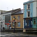
Entrance to Audierne, Penryn
From Lower Market Street, this is the entrance to Audierne,
a sheltered housing complex which is named after Penryn's twin town in Brittany.
Image: © Jaggery
Taken: 16 Oct 2015
0.01 miles
2
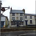
Broad Street, Penryn
Pedestrian crossing close to the post office; an old milestone records Falmouth:2 miles and Truro:8 miles
Image: © David Smith
Taken: 22 Mar 2013
0.01 miles
3
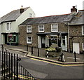
Seven Stars inn, The Terrace, Penryn
The pavement on the south side of the road is raised above the road level. Were there ever windows above the door?
Image: © David Smith
Taken: 22 Mar 2013
0.02 miles
4
The Seven Stars inn, Penryn
In the foreground is a milestone which records the distances Helston:20 miles, Penzance:23 miles
Image: © David Smith
Taken: 22 Mar 2013
0.02 miles
5
Seven Stars Inn and bus shelter, Penrhyn
The bus shelter looks new, but is trying to look old.
Image: © Humphrey Bolton
Taken: 6 Jan 2016
0.02 miles
6
Diva, Penryn
Hair & beauty salon at 92 Lower Market Street.
Image: © Jaggery
Taken: 16 Oct 2015
0.02 miles
7
Seven Stars in Penryn
Town centre pub at 73 The Terrace, on the corner of Chapel Lane.
Image: © Jaggery
Taken: 16 Oct 2015
0.02 miles
8
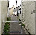
Northern end of Chapel Lane, Penryn
Chapel Lane ascends from Lower Market Street.
Image: © Jaggery
Taken: 16 Oct 2015
0.02 miles
9
Old Milestone in Lower Market Street, Penryn
Carved stone post by the UC road, in parish of PENRYN (CARRICK District), The Terrace, North West of No. 67, at junction set in surface, on South side of road. Helston facets, erected by the Helston turnpike trust in the 19th century.
Inscription reads:-
: HELSTON / 10 / PENZANCE / 23 : : FALMOUTH / 2 / TRURO / 8 :
Grade II Listed. List Entry Number: 1025071
https://historicengland.org.uk/listing/the-list/list-entry/1025071
Milestone Society National ID: CW_PZHL23.
Image: © Ian Thompson
Taken: 10 Dec 2017
0.03 miles
10
Old Milestone in Lower Market Street, Penryn
Carved stone post by the UC road, in parish of PENRYN (CARRICK District), The Terrace, Northwest of No. 67, at junction set in surface, on South side of road. Helston facets, erected by the Helston turnpike trust in the 19th century.
Inscription reads:-
: FALMOUTH / 2 / TRURO / 8 : : HELSTON / 10 / PENZANCE / 23 :
Grade II listed.
List Entry Number: 1025071 https://historicengland.org.uk/listing/the-list/list-entry/1025071
Milestone Society National ID: CW_PZHL23.
Image: © Rosy Hanns
Taken: 27 Jun 2019
0.03 miles


