
IMAGES TAKEN NEAR TO
Church Court, TOTNES, TQ9 7UG
Introduction
This page details the photographs taken nearby to Church Court, TQ9 7UG by members of the Geograph project.
The Geograph project started in 2005 with the aim of publishing, organising and preserving representative images for every square kilometre of Great Britain, Ireland and the Isle of Man.

There are currently over 7.5m images from over14,400 individuals and you can help contribute to the project by visiting https://www.geograph.org.uk
Image Map
Images are licensed for reuse under creativecommons.org/licenses/by-sa/2.0
Notes
- Clicking on the map will re-center to the selected point.
- The higher the marker number, the further away the image location is from the centre of the postcode.
Image Listing (37 Images Found)
Images are licensed for reuse under creativecommons.org/licenses/by-sa/2.0
Image
Details
Distance
1
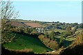
Harberton, a typical South Hams village in Devon
Image: © Martin Stokes
Taken: 26 Oct 2003
0.02 miles
2
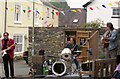
Jubilee music, Harberton
The Alfi Romeo Band provide music outside the Church House Inn as part of the Diamond Jubilee celebrations, although they made the unforgivable faux pas of referring to the venue as "Harbertonford".
Image: © Derek Harper
Taken: 2 Jun 2012
0.02 miles
3
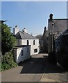
Tristford Road, Harberton
Several South Hams villages are a real jumble of buildings and lanes, and Harberton is an example.
Image: © Derek Harper
Taken: 16 Apr 2014
0.03 miles
4
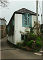
Cottage, Harberton
A cottage we once looked round whilst house-hunting, but that was decades ago.
Image: © Derek Harper
Taken: 29 Mar 2022
0.04 miles
5
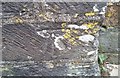
Ordnance Survey Cut Mark
This OS cut mark can be found on the west face of St Andrew's Church. It marks a point 79.275m above mean sea level.
Image: © Adrian Dust
Taken: 29 Mar 2019
0.05 miles
6

Harberton - St Andrew's Church - Norman font
The C12th font in Image] is of red sandstone with a deep round bowl on a low circular shaft. The bowl has a frieze of ten medallions of star pattern with cable mould below and double fluting below that.
Image: © Rob Farrow
Taken: 27 Aug 2023
0.05 miles
7
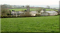
Harberton from the north
The tower of the grade I listed https://historicengland.org.uk/listing/the-list/list-entry/1108222 St Andrew's church rises above the village. Seen from where Image] was taken, looking left.
Image: © Derek Harper
Taken: 18 Apr 2019
0.05 miles
8
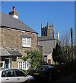
Harberton
The tower of the grade I listed http://list.english-heritage.org.uk/resultsingle.aspx?uid=1108222&searchtype=mapsearch St Andrew's church rises above roofs - to be precise the roof of the School House http://list.english-heritage.org.uk/resultsingle.aspx?uid=1215893&searchtype=mapsearch . Scene in Fore Street.
Image: © Derek Harper
Taken: 16 Apr 2014
0.05 miles
9
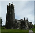
Harberton - St Andrew's Church
A view of St Andrew's Church, Harberton from just inside the western gate into its churchyard.
See shared description below.
Image: © Rob Farrow
Taken: 27 Aug 2023
0.05 miles
10
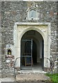
Harberton - St Andrew's Church - South porch entrance
This is the main entrance to Image] and is situated in the double height south porch of the church. Note the little piscina-like niche to the left of the door and the old sundial above it.
Image: © Rob Farrow
Taken: 27 Aug 2023
0.05 miles