
IMAGES TAKEN NEAR TO
Greenhill Terrace, Greenhill, TOTNES, TQ9 7RB
Introduction
This page details the photographs taken nearby to Greenhill Terrace, Greenhill, TQ9 7RB by members of the Geograph project.
The Geograph project started in 2005 with the aim of publishing, organising and preserving representative images for every square kilometre of Great Britain, Ireland and the Isle of Man.

There are currently over 7.5m images from over14,400 individuals and you can help contribute to the project by visiting https://www.geograph.org.uk
Image Map
Images are licensed for reuse under creativecommons.org/licenses/by-sa/2.0
Notes
- Clicking on the map will re-center to the selected point.
- The higher the marker number, the further away the image location is from the centre of the postcode.
Image Listing (43 Images Found)
Images are licensed for reuse under creativecommons.org/licenses/by-sa/2.0
Image
Details
Distance
1
East Allington
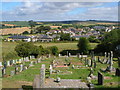
From the churchyard, a view showing the westward growth of the village away from the main street (where cars are parked on the right hand side of the photo). Beyond, the rolling open South Hams countryside to the north.
Image: © Derek Harper
Taken: 28 Jul 2006
0.02 miles
3
The Fortesque Arms
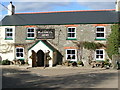
A friendly pub with a good welcome and well kept beer. Food on some nights too.
Image: © Stuart Logan
Taken: 7 Oct 2013
0.03 miles
4
The Fortescue Arms
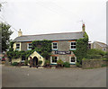
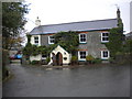
Situated on the corner of Greenhill and the main road through East Allington.
Image: © jeff collins
Taken: 6 Nov 2013
0.03 miles
5
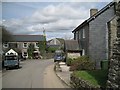
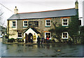
Below the church
The Fortescue Arms stands on the corner of the main street and Greenhill.
Image: © Robin Stott
Taken: 2 Apr 2011
0.05 miles
7
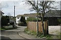
Houses, Addlehole
A small development on the west side of the village.
Image: © Robin Stott
Taken: 2 Apr 2011
0.06 miles
8
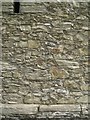
Masonry near Bunkers Farm
The pieces of rubble in the wall reveal folds in the parent rock.
Image: © Robin Stott
Taken: 2 Apr 2011
0.06 miles
9
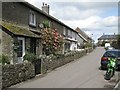
Cottages, Vineyard Terrace
Sheltered parts of the South Hams are almost sub-tropical. Here is a Camellia in flower beside a Cordyline.
Image: © Robin Stott
Taken: 2 Apr 2011
0.07 miles
10
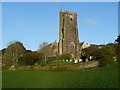
St Andrew's Church, East Allington
It was in this church, on the 12th November 1943, that the announcement was first made to the people of The South Hams that many of them were to be evacuated from the area by 20th December. Although nobody was told the reason, it was because The War Office had chosen to use Slapton beach as a major practice area for the D-Day landings.
Image: © Robin Drayton
Taken: 26 Apr 2010
0.07 miles