IMAGES TAKEN NEAR TO
Diptford, TOTNES, TQ9 7LU
Introduction
This page details the photographs taken nearby to TQ9 7LU by members of the Geograph project.
The Geograph project started in 2005 with the aim of publishing, organising and preserving representative images for every square kilometre of Great Britain, Ireland and the Isle of Man.

There are currently over 7.5m images from over14,400 individuals and you can help contribute to the project by visiting https://www.geograph.org.uk
Image Map
Images are licensed for reuse under creativecommons.org/licenses/by-sa/2.0
Notes
- Clicking on the map will re-center to the selected point.
- The higher the marker number, the further away the image location is from the centre of the postcode.
Image Listing (10 Images Found)
Images are licensed for reuse under creativecommons.org/licenses/by-sa/2.0
Image
Details
Distance
3
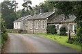
The former station buildings at Avonwick
The original station buildings can be made out against the more modern extension at the far end. The station shut September 1963.
Image: © roger geach
Taken: 21 Sep 2010
0.06 miles
4
The Former Avonwick Station
Situated in a very unspoilt location this was one of the stations on the South Brent to Kingsbridge branch. Closed in Sept 1963 the building this end is much newer and is not part of the original station buildings. Now a private dwelling parts of the platform can be clearly seen.
Image: © roger geach
Taken: 21 Sep 2010
0.06 miles
5
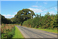
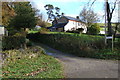
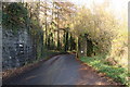
Near Beneknowle Farm
Road next to Beneknowle Farm
Image: © Wayland Smith
Taken: 26 Sep 2020
0.08 miles
6
Remnants of a railway station...
This is the end of the platform at what was Avonwick Station on the South Brent to Kingsbridge line. It is now a private dwelling. The building in the picture appears to be an extension to the original station building.
Image: © Ruth Sharville
Taken: 16 Nov 2008
0.08 miles
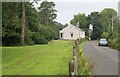
7
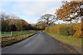
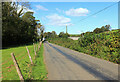
The road to Avonwick
Taken from the Higher beneknowle junction, the electricity wires give you a precise location.
Image: © Ruth Sharville
Taken: 16 Nov 2008
0.11 miles
8
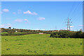
Field near Avonwick
Field and power line near Avonwick.
Image: © Wayland Smith
Taken: 26 Sep 2020
0.13 miles
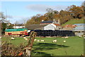
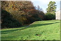
9
Former Railway Line
This is the route of the South Brent to Kingsbridge railway. The distant building was the station at Avonwick.
Image: © Wayland Smith
Taken: 26 Sep 2020
0.13 miles
10
Site of former railway bridge
These buttresses are all that's left of the South Brent to Kingsbridge line bridge near what was Avonwick Station. Sadly, bridges like this along the line were blown soon after the line closed...
Image: © Ruth Sharville
Taken: 16 Nov 2008
0.22 miles