
IMAGES TAKEN NEAR TO
Harbertonford, TOTNES, TQ9 7HT
Introduction
This page details the photographs taken nearby to TQ9 7HT by members of the Geograph project.
The Geograph project started in 2005 with the aim of publishing, organising and preserving representative images for every square kilometre of Great Britain, Ireland and the Isle of Man.

There are currently over 7.5m images from over14,400 individuals and you can help contribute to the project by visiting https://www.geograph.org.uk
Image Map
Images are licensed for reuse under creativecommons.org/licenses/by-sa/2.0
Notes
- Clicking on the map will re-center to the selected point.
- The higher the marker number, the further away the image location is from the centre of the postcode.
Image Listing (26 Images Found)
Images are licensed for reuse under creativecommons.org/licenses/by-sa/2.0
Image
Details
Distance
1
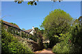
Middle Luscombe
A view from down the lane of the listed piggery https://historicengland.org.uk/listing/the-list/list-entry/1216091 and farmhouse https://historicengland.org.uk/listing/the-list/list-entry/1287776 also shown in Image
Image: © Derek Harper
Taken: 22 May 2019
0.05 miles
2
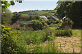
Luscombe
A view from the lane westwards from the hamlet. Most of the buildings visible are at Middle Luscombe Image
Image: © Derek Harper
Taken: 22 May 2019
0.06 miles
3
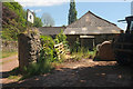
Higher Luscombe
The sign advertises "The Luscombe Herd" of "British Friesians". On the left can be glimpsed the roof of the listed farmhouse https://historicengland.org.uk/listing/the-list/list-entry/1108236 .
Image: © Derek Harper
Taken: 22 May 2019
0.07 miles
4
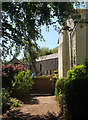
Middle Luscombe
"House, formerly a farmhouse known as Skindles Farmhouse. Circa early C17" https://historicengland.org.uk/listing/the-list/list-entry/1287776 . Also listed are "Barn, Shippon and cider house range" https://historicengland.org.uk/listing/the-list/list-entry/1108237, centre right, and, with gable end on the left, a piggery https://historicengland.org.uk/listing/the-list/list-entry/1216091 .
Image: © Derek Harper
Taken: 22 May 2019
0.07 miles
5
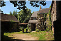
Higher Luscombe Cottage
"Cottage, formerly a farmhouse. Circa early to mid C16, remodelled and extended in circa early C17" https://historicengland.org.uk/listing/the-list/list-entry/1325047 . On the right is the barn shown in Image] https://historicengland.org.uk/listing/the-list/list-entry/1216068 .
Image: © Derek Harper
Taken: 22 May 2019
0.07 miles
6
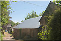
Buildings at Luscombe
On the immediate right is the northern gable of Higher Luscombe Cottage https://historicengland.org.uk/listing/the-list/list-entry/1325047 Image], with, in the centre, the listed barn https://historicengland.org.uk/listing/the-list/list-entry/1216068 that was built onto it in the eighteenth century. You can perhaps make out the "external steps up to loft doorway". The farmhouse along the drive on the left is Luscombe Farm https://historicengland.org.uk/listing/the-list/list-entry/1108236 , mapped as Higher Luscombe; see also Image
Image: © Derek Harper
Taken: 22 May 2019
0.07 miles
7
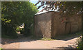
Barn, Luscombe
"Barn converted into stables with hay loft above. Probably C18, converted in circa early C20" https://historicengland.org.uk/listing/the-list/list-entry/1216068 .
Image: © Derek Harper
Taken: 22 May 2019
0.07 miles
8
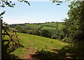
Field above the Harbourne valley
The view from the gateway seen in Image
Image: © Derek Harper
Taken: 22 May 2019
0.11 miles
9
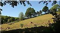
Field above Luscombe
A hillside field beside the sunken lane seen in Image
Image: © Derek Harper
Taken: 22 May 2019
0.13 miles
10
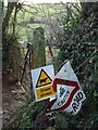
Oops
The mangled state of the sign perhaps gives a more powerful message than the words on it. I blame those speeding cows.
Image: © Derek Harper
Taken: 18 Jan 2009
0.13 miles