
IMAGES TAKEN NEAR TO
Cornworthy, TOTNES, TQ9 7HD
Introduction
This page details the photographs taken nearby to TQ9 7HD by members of the Geograph project.
The Geograph project started in 2005 with the aim of publishing, organising and preserving representative images for every square kilometre of Great Britain, Ireland and the Isle of Man.

There are currently over 7.5m images from over14,400 individuals and you can help contribute to the project by visiting https://www.geograph.org.uk
Image Map
Images are licensed for reuse under creativecommons.org/licenses/by-sa/2.0
Notes
- Clicking on the map will re-center to the selected point.
- The higher the marker number, the further away the image location is from the centre of the postcode.
Image Listing (58 Images Found)
Images are licensed for reuse under creativecommons.org/licenses/by-sa/2.0
Image
Details
Distance
1
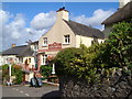
Hunters' Lodge, Cornworthy
A village pub with a good reputation for food.
Image: © Derek Harper
Taken: 30 Jul 2006
0.02 miles
2
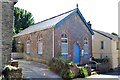
Former Cornworthy Methodist Church, Abbey Road
At the time of submission, June 2014, Google Streetview showed a For Sale sign outside the building.
Image: © Robin Stott
Taken: 5 Jul 2013
0.03 miles
3
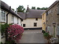
Alexandra Place, Cornworthy
Looking down Alexandra Place to its junction with the main lane through Cornworthy.
Image: © Derek Harper
Taken: 23 Jun 2006
0.03 miles
4
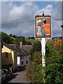
Cornworthy
The gatehouse (about 1400), all that is left standing of the Augustinian Priory, in the distance above a view down the main street of Cornworthy past the Hunters' Lodge pub sign.
Image: © Derek Harper
Taken: 30 Jul 2006
0.03 miles
5
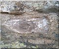
Ordnance Survey Cut Mark
This OS cut mark can be found on Virginia Cottage. It marks a point 73.600m above mean sea level.
Image: © Adrian Dust
Taken: 26 Mar 2019
0.04 miles
6
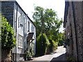
Cornworthy
Looking up towards the church past cottages on the steep village street.
Image: © Derek Harper
Taken: 30 Jul 2006
0.04 miles
7
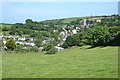
Cornworthy, from near the Priory gatehouse
In the centre Abbey Road climbs to the parish church. Priory View, a 20th-century development, rises on the left.
Image: © Robin Stott
Taken: 5 Jul 2013
0.05 miles
8
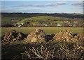
View over Cornworthy
From Water Lane near Furzehill Cross, with manure piles waiting to be spread.
Image: © Derek Harper
Taken: 17 Feb 2015
0.05 miles
9
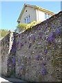
Purple flowers on a retaining wall, Abbey Road, Cornworthy
On a steep hillside, several houses at the top of Abbey Road are perched above the street supported by a retaining wall. This house is thought to be called High Walls. On the wall the reddish leaves and large flowers suggest a variety of Campanula; Aubrieta will cling to walls too but its foliage is grey-green and the flowers are smaller.
Image: © Robin Stott
Taken: 5 Jul 2013
0.06 miles
10
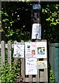
Notices on the corner of Priory View, Cornworthy
Every BT pole and adjacent fence in the village had its array of notices and information – sign of an active community, surely.
Image: © Robin Stott
Taken: 5 Jul 2013
0.07 miles