
IMAGES TAKEN NEAR TO
Orchard Close, TOTNES, TQ9 7EX
Introduction
This page details the photographs taken nearby to Orchard Close, TQ9 7EX by members of the Geograph project.
The Geograph project started in 2005 with the aim of publishing, organising and preserving representative images for every square kilometre of Great Britain, Ireland and the Isle of Man.

There are currently over 7.5m images from over14,400 individuals and you can help contribute to the project by visiting https://www.geograph.org.uk
Image Map
Images are licensed for reuse under creativecommons.org/licenses/by-sa/2.0
Notes
- Clicking on the map will re-center to the selected point.
- The higher the marker number, the further away the image location is from the centre of the postcode.
Image Listing (47 Images Found)
Images are licensed for reuse under creativecommons.org/licenses/by-sa/2.0
Image
Details
Distance
1
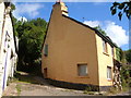
Cottages in Cornworthy
Unusual carved columns by the front door of a cottage in Cornworthy. The track between the cottages is Hothill Lane, which climbs over Corkscrew Hill to Tuckenhay. Cornworthy Footpath 1b passes the columns and heads downhill to Bow Creek.
Image: © Derek Harper
Taken: 30 Jul 2006
0.02 miles
2
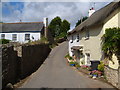
Cottages in Abbey Road, Cornworthy
Scene towards the western end of Cornworthy.
Image: © Derek Harper
Taken: 30 Jul 2006
0.03 miles
3
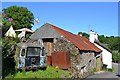
Building with a rusty roof, Abbey Road, Cornworthy
A multi-purpose building? Windows below, perhaps a cart shed, and a loft or room above.
Image: © Robin Stott
Taken: 5 Jul 2013
0.03 miles
4
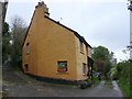
Parting of the Ways
This house stands at the point where two paths leaving Cornworthy separate. The right hand one goes north to Bow Creek and the left hand one goes north west round Corkscrew Hill to Tuckenhay
Image: © Nigel Mykura
Taken: 6 Dec 2009
0.04 miles
5
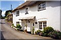
Fuchsia Cottage, Abbey Road, Cornworthy, in 2002
Image: © David Gearing
Taken: 16 Jul 2002
0.05 miles
6
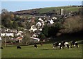
Cornworthy
The village seen from beside Image], with the church at the top of the hill.
Image: © Derek Harper
Taken: 17 Feb 2015
0.05 miles
7

Notices on the corner of Priory View, Cornworthy
Every BT pole and adjacent fence in the village had its array of notices and information – sign of an active community, surely.
Image: © Robin Stott
Taken: 5 Jul 2013
0.08 miles
8
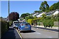
Priory View, Cornworthy
A late twentieth-century residential development running north from Abbey Road.
Image: © Robin Stott
Taken: 5 Jul 2013
0.08 miles
9
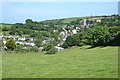
Cornworthy, from near the Priory gatehouse
In the centre Abbey Road climbs to the parish church. Priory View, a 20th-century development, rises on the left.
Image: © Robin Stott
Taken: 5 Jul 2013
0.10 miles
10
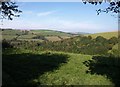
Field with view on Hothill lane
From a green lane between Cornworthy and Tuckenhay, a view over the brow of a field to Charleycombe Wood, young woodland on a valley side, which crosses into Image The green water of Bow Creek can be seen on the left, with fields on the far side climbing east of Ashprington.
Image: © Derek Harper
Taken: 27 Sep 2009
0.10 miles