
IMAGES TAKEN NEAR TO
Ashprington, TOTNES, TQ9 7ED
Introduction
This page details the photographs taken nearby to TQ9 7ED by members of the Geograph project.
The Geograph project started in 2005 with the aim of publishing, organising and preserving representative images for every square kilometre of Great Britain, Ireland and the Isle of Man.

There are currently over 7.5m images from over14,400 individuals and you can help contribute to the project by visiting https://www.geograph.org.uk
Image Map
Images are licensed for reuse under creativecommons.org/licenses/by-sa/2.0
Notes
- Clicking on the map will re-center to the selected point.
- The higher the marker number, the further away the image location is from the centre of the postcode.
Image Listing (36 Images Found)
Images are licensed for reuse under creativecommons.org/licenses/by-sa/2.0
Image
Details
Distance
1
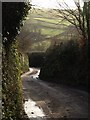
Lane to Bow Bridge
A steep narrow lane which sees much traffic as it connects Totnes with several villages and popular pubs. It is dropping into the Harbourne river valley, and is seen here from Image On the far side is the lane up to Yetson.
Image: © Derek Harper
Taken: 18 Jan 2009
0.06 miles
2
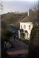
Cross Lanes
A little row of cottages stands on Smallwell lane, a green lane which forms a crossroads with the steep lane (the sunlit road surface) from Ashprington Cross to Bow Bridge.
Image: © Derek Harper
Taken: 18 Jan 2009
0.09 miles
3
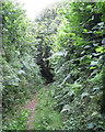
Green lane to Cross Lanes and Ashprington
Image: © Robin Stott
Taken: 19 Jul 2011
0.09 miles
4

Smallwell Lane east of Cross Lanes
Nearing a house called Hothole.
Image: © Robin Stott
Taken: 19 Jul 2011
0.10 miles
5

Track to Western Barn
The track leading to Image, at the mouth of a deep little side valley of the Harbourne River valley.
Image: © Derek Harper
Taken: 18 Jan 2009
0.12 miles
6
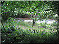
Harbourne River or a side-stream
It flows into Bow Creek, a branch of the tidal Dart estuary.
Image: © Robin Stott
Taken: 19 Jul 2011
0.12 miles
7
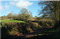
Lanes near Bow
More correctly, a lane and a green lane, the latter (Smallwell Lane) carrying a route with public access up the side of the Harbourne valley.
Image: © Derek Harper
Taken: 9 Feb 2018
0.13 miles
8
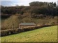
Western Barn
A converted barn on the slopes of the Harbourne River valley, seen from Smallwell Lane. Above is Stancombe Wood, in SX8057.
Image: © Derek Harper
Taken: 18 Jan 2009
0.16 miles
9
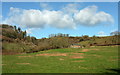
Western Barn
The converted barn shown in Image, seen from where Image was taken looking left. In the background is Stancombe Wood.
Image: © Derek Harper
Taken: 9 Feb 2018
0.16 miles
