
IMAGES TAKEN NEAR TO
Barn Park, TOTNES, TQ9 6SR
Introduction
This page details the photographs taken nearby to Barn Park, TQ9 6SR by members of the Geograph project.
The Geograph project started in 2005 with the aim of publishing, organising and preserving representative images for every square kilometre of Great Britain, Ireland and the Isle of Man.

There are currently over 7.5m images from over14,400 individuals and you can help contribute to the project by visiting https://www.geograph.org.uk
Image Map
Images are licensed for reuse under creativecommons.org/licenses/by-sa/2.0
Notes
- Clicking on the map will re-center to the selected point.
- The higher the marker number, the further away the image location is from the centre of the postcode.
Image Listing (77 Images Found)
Images are licensed for reuse under creativecommons.org/licenses/by-sa/2.0
Image
Details
Distance
1
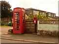
Stoke Gabriel: postbox № TQ9 39 and phone, Barn Park
The little postbox serves the northern part of the village and is emptied finally at 5:15pm on weekdays and at five past ten on Saturday mornings.
Image: © Chris Downer
Taken: 27 Aug 2009
0.03 miles
2
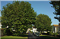
Barn Park, Stoke Gabriel
Senn from the junction where Image] was taken, looking to the left.
Image: © Derek Harper
Taken: 27 Sep 2018
0.04 miles
3
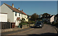
Barn Park, Stoke Gabriel
Terraced housing curving around a bend on the road to the right at the T junction visible in Image
Image: © Derek Harper
Taken: 27 Sep 2018
0.04 miles
4
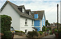
Houses, Stoke Gabriel
On Flood Street; the blue house with white quoins is called, a little worryingly, Flood Cottage.
Image: © Derek Harper
Taken: 23 May 2019
0.05 miles
5
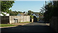
Flood Street, Stoke Gabriel
From the junction with Barn Park (left).
Image: © Derek Harper
Taken: 27 Sep 2018
0.05 miles
6
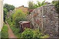
Footpath, Stoke Gabriel
Stoke Gabriel footpath 10, seen here leaving Flood Street, is not a lengthy affair; 51 metres according to http://www.rowmaps.com/showmap.php?place=Stoke%20Gabriel&map=BingOS&lat=50.4033&lon=3.62114&lonew=W before it emerges onto Vicarage Grove.
Image: © Derek Harper
Taken: 23 May 2019
0.06 miles
7
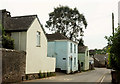
Paignton Road, Stoke Gabriel
Two houses on the east side of the road, followed by the Baptist church hall. See Image] for what lies around the corner...
Image: © Derek Harper
Taken: 23 May 2019
0.06 miles
8
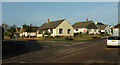
Pound Field, Stoke Gabriel
The junction with Aish Road (right).
Image: © Derek Harper
Taken: 29 Nov 2020
0.07 miles
9
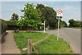
Rydon Cross
Aish Road turns left from Paignton Road here.
Image: © Derek Harper
Taken: 23 May 2019
0.07 miles
10
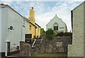
Baptist Church, Stoke Gabriel
A slightly different angle on Image
Image: © Derek Harper
Taken: 23 May 2019
0.08 miles