
IMAGES TAKEN NEAR TO
Stoke Gabriel, TOTNES, TQ9 6RN
Introduction
This page details the photographs taken nearby to TQ9 6RN by members of the Geograph project.
The Geograph project started in 2005 with the aim of publishing, organising and preserving representative images for every square kilometre of Great Britain, Ireland and the Isle of Man.

There are currently over 7.5m images from over14,400 individuals and you can help contribute to the project by visiting https://www.geograph.org.uk
Image Map
Images are licensed for reuse under creativecommons.org/licenses/by-sa/2.0
Notes
- Clicking on the map will re-center to the selected point.
- The higher the marker number, the further away the image location is from the centre of the postcode.
Image Listing (62 Images Found)
Images are licensed for reuse under creativecommons.org/licenses/by-sa/2.0
Image
Details
Distance
1

Whitehill Lane #8
The green lane / route with public access approaching Tullys Mead Farm. Ahead is Whitehill Copse.
Image: © Derek Harper
Taken: 25 May 2017
0.01 miles
2

Whitehill Lane
The green lane and route with public access at a crossroads; the track on the right is shown in Image On the left is Tullys Mead Farm.
Image: © Derek Harper
Taken: 4 Jul 2019
0.02 miles
3

Track to Higher Well Farm Holiday Park
The surface has been upgraded in the two years since Image was taken.
Image: © Derek Harper
Taken: 4 Jul 2019
0.02 miles
4

Track from Whitehill Lane
Leading towards Higher Well Farm Holiday Park.
Image: © Derek Harper
Taken: 25 May 2017
0.02 miles
5

Puddle, Whitehill Lane
More shallow water southwest of Image
Image: © Derek Harper
Taken: 19 Dec 2020
0.04 miles
6

Whitehill Lane #10
Another view, from the other direction, of the double bend and sign shown in Image
Image: © Derek Harper
Taken: 25 May 2017
0.04 miles
7

Whitehill Lane #9
Passing the junction with the track to Well Cottage. The sign on the left reads:" Tullys Mead Farm next on right".
Image: © Derek Harper
Taken: 25 May 2017
0.04 miles
8

Puddle, Whitehill Lane
A reverse view of Image
Image: © Derek Harper
Taken: 19 Dec 2020
0.04 miles
9
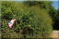
Double bend sign, Whitehill Lane
Two years and some weeks later, and the sign shown in Image is becoming buried in undergrowth.
Image: © Derek Harper
Taken: 4 Jul 2019
0.05 miles
10
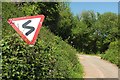
Double bend sign, Whitehill Lane
At a precarious angle, changing the symbol into an "S". The double bend to which it refers is shown in Image
Image: © Derek Harper
Taken: 25 May 2017
0.05 miles