
IMAGES TAKEN NEAR TO
Broadhempston, TOTNES, TQ9 6BD
Introduction
This page details the photographs taken nearby to TQ9 6BD by members of the Geograph project.
The Geograph project started in 2005 with the aim of publishing, organising and preserving representative images for every square kilometre of Great Britain, Ireland and the Isle of Man.

There are currently over 7.5m images from over14,400 individuals and you can help contribute to the project by visiting https://www.geograph.org.uk
Image Map
Images are licensed for reuse under creativecommons.org/licenses/by-sa/2.0
Notes
- Clicking on the map will re-center to the selected point.
- The higher the marker number, the further away the image location is from the centre of the postcode.
Image Listing (31 Images Found)
Images are licensed for reuse under creativecommons.org/licenses/by-sa/2.0
Image
Details
Distance
1
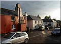
Broadhempston after the downpour
The main village street seen from just in front of the Coppa Dolla Inn. Three hours of torrential rain have ended and an evening sun has emerged. Even the cars look fresh.
Image: © Derek Harper
Taken: 30 May 2008
0.02 miles
2
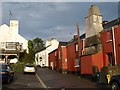
Village street, Broadhempston
On the left is the Coppa Dolla Inn, formerly the New Inn. Barters, on the right, is a listed building that was formerly thatched. Thanks to Robin Stott for pointing out the date "1473 AD" on the gable in the centre. This is curious as the listed building description only dates the building back to "probably C16" http://www.britishlistedbuildings.co.uk/en-84775-barters-broadhempston , describing Barters as "one of the more important farmhouses in the village in the C17 and despite extensive C20 modernisation it still retains a number of interesting features of C17".
Image: © Derek Harper
Taken: 30 May 2008
0.03 miles
3
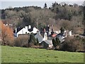
A View Over Broadhempston
Using a bit of zoom to view some of the houses set close to the main village street Broadhempston. This is only a small part of the village which straggles along the road for about two thirds of a mile.
Image: © Tony Atkin
Taken: 26 Feb 2012
0.04 miles
4
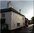
Cottage, Broadhempston
The wall of a cottage (one of those in Image) catches the evening sun.
Image: © Derek Harper
Taken: 30 May 2008
0.04 miles
5
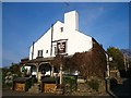
The Coppa Dolla
The unusual name of this 17th century pub means 'coppiced alder tree'.
Today its claim to fame is the 'two-in-one pie' consisting of meat in one half and cauliflower cheese in the other.
Image: © Mark Percy
Taken: 9 Apr 2015
0.05 miles

7
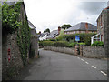
Village street, Broadhempston
The colour of the building stone is a neutral grey; a reddish tinge is given by a powdery lichen the colour of dried blood. The postbox number is TQ9 61.
Image: © Robin Stott
Taken: 15 Jul 2010
0.07 miles
8
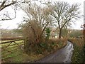
Daniel's Lane, Broadhempston
The back lane also shown in Image, dropping down from Wotten Way past small fields and orchards.
Image: © Derek Harper
Taken: 24 Feb 2010
0.07 miles
9
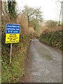
Notice on Daniel's Lane, Broadhempston
A Sat Nav warning notice at the southern end of this little back lane, linking Wotten Way to the main village street.
Image: © Derek Harper
Taken: 24 Feb 2010
0.12 miles
10
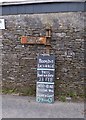
Old Direction Sign - Signpost in Broadhempston
Annulus lost finial - 1 arm (2 missing; 1 in wall opposite); H-section Newton Abbot RDC halo by the UC road, in parish of Broadhempston (Teignbridge District), Lower Well junction with Daniel's Lane, against stone wall of farm (finial lost since Streetview filming).
Surveyed
Milestone Society National ID: DV_SX8066
Image: © Alan Rosevear
Taken: 22 Feb 2013
0.13 miles