
IMAGES TAKEN NEAR TO
Sawmill Close, TOTNES, TQ9 5WT
Introduction
This page details the photographs taken nearby to Sawmill Close, TQ9 5WT by members of the Geograph project.
The Geograph project started in 2005 with the aim of publishing, organising and preserving representative images for every square kilometre of Great Britain, Ireland and the Isle of Man.

There are currently over 7.5m images from over14,400 individuals and you can help contribute to the project by visiting https://www.geograph.org.uk
Image Map
Images are licensed for reuse under creativecommons.org/licenses/by-sa/2.0
Notes
- Clicking on the map will re-center to the selected point.
- The higher the marker number, the further away the image location is from the centre of the postcode.
Image Listing (364 Images Found)
Images are licensed for reuse under creativecommons.org/licenses/by-sa/2.0
Image
Details
Distance

5

River Dart by St Peter's Quay
The Dart leaves Totnes between Steamer Quay Road (on the far bank) and the Steam Packet pub on the right.
Image: © Derek Harper
Taken: 18 Jan 2009
0.03 miles
6
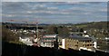
New dwellings, St Peter's Quay, Totnes
A mixture of flats and houses is taking shape beside the Dart. The footpath carrying the Dart Valley Trail and the John Musgrave Heritage Trail has had to be diverted from the field at the rear of Baltic Wharf. In the foreground is the shaded fence that surrounds the site, here running alongside NCN28. In the background are Totnes Bridge and Brutus Bridge across the River Dart.
Image: © Derek Harper
Taken: 28 Feb 2016
0.03 miles
7
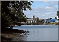
Home Reach on the Dart
For the vest part of two kilometres downstream from Totnes, the River Dart pursues an almost straight course. This is the last 800 metres of that reach (if you're heading upstream). St Mary's church is the obvsious draw; the new flats on St Peters Quay also catch the eye.
Image: © Derek Harper
Taken: 14 Aug 2016
0.03 miles
8
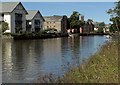
River Dart just below Totnes
With modern flats on the other bank. In the centre, the older grey building consists of flats adjacent to the Steam Packet pub.
Image: © Derek Harper
Taken: 26 Aug 2016
0.03 miles
9
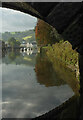
River Dart at Totnes
Looking beneath an arch of Totnes Bridge towards Tor House (Devon & Cornwall Housing). The trees on the right are on Vire Island.
Image: © Derek Harper
Taken: 15 Oct 2021
0.03 miles
