
IMAGES TAKEN NEAR TO
Victoria Street, TOTNES, TQ9 5TR
Introduction
This page details the photographs taken nearby to Victoria Street, TQ9 5TR by members of the Geograph project.
The Geograph project started in 2005 with the aim of publishing, organising and preserving representative images for every square kilometre of Great Britain, Ireland and the Isle of Man.

There are currently over 7.5m images from over14,400 individuals and you can help contribute to the project by visiting https://www.geograph.org.uk
Image Map
Images are licensed for reuse under creativecommons.org/licenses/by-sa/2.0
Notes
- Clicking on the map will re-center to the selected point.
- The higher the marker number, the further away the image location is from the centre of the postcode.
Image Listing (986 Images Found)
Images are licensed for reuse under creativecommons.org/licenses/by-sa/2.0
Image
Details
Distance
1
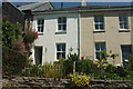
Houses on Victoria Street, Totnes
Image: © Derek Harper
Taken: 15 Jun 2021
0.01 miles
2
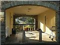
Arches, Victoria Court, Totnes
Looking through from Victoria Street with The Carrions visible through the arch.
Image: © Derek Harper
Taken: 5 Jan 2022
0.01 miles
3
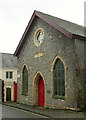
Totnes Parish Church Mission Hall
On Victoria Road, and indeed named Victoria House by the front door. An inscribed corner stone dates it to 1890.
Image: © Derek Harper
Taken: 17 Dec 2020
0.01 miles
4
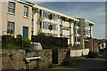
Russell Court, Totnes
Flats on Victoria Street, with an older house on the left.
Image: © Derek Harper
Taken: 17 Mar 2021
0.02 miles
5
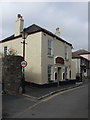
Waterman's Arms, Totnes
Greene King IPA the only beer at this friendly local -well away from the Water!
Image: © al partington
Taken: 12 Jul 2007
0.02 miles
6
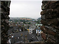
From Totnes Castle
Looking towards the south east and Dartmouth from the top of the keep at Totnes Castle. The River Dart can be seen in the distance with the open farmland rising on the left. The façades of the High Street can be seen in the foreground.
Totnes Castle is a classic Norman motte and bailey castle owned by English Heritage. It was founded soon after the Norman Conquest in 1068 by Juhel of Totnes to subdue the Saxon town. At the beginning of the 13th century the shell-keep was constructed by William de Braose but by the end of the century this had fallen into disrepair. The castle, which had passed to the Northamptonshire de la Zouch family by marriage, was subject to a Royal order in 1326 requiring the structure to be refortified and, although the buildings in the bailey were left to deteriorate, a stone curtain wall was built. The keep was also rebuilt and maintained until the late 15th century. It is this building that crowns the steep castle mound, which allows these spectacular views across the town rooftops.
Image: © Kate Jewell
Taken: 30 Jul 2008
0.02 miles
7
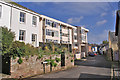
Modern flats in Victoria Street
Close to the historic town centre of Totnes.
Image: © Richard Dorrell
Taken: 5 Nov 2013
0.02 miles
8
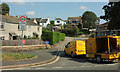
The Grove, Totnes
Across the junction with St Katherine's Way.
Image: © Derek Harper
Taken: 2 Aug 2019
0.02 miles
9
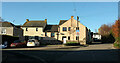
Houses, The Grove, Totnes
Looking right from Image
Image: © Derek Harper
Taken: 5 Jan 2022
0.02 miles
10
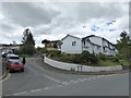
Carrions, Totnes
A modern development of housing south of the old centre of Totnes
Image: © David Smith
Taken: 27 Apr 2017
0.03 miles