IMAGES TAKEN NEAR TO
Priory Terrace, TOTNES, TQ9 5QE

Introduction

This page details the photographs taken nearby to Priory Terrace, TQ9 5QE by members of the Geograph project.

The Geograph project started in 2005 with the aim of publishing, organising and preserving representative images for every square kilometre of Great Britain, Ireland and the Isle of Man.

There are currently over 7.5m images from over14,400 individuals and you can help contribute to the project by visiting https://www.geograph.org.uk

Image Map


Images are licensed for reuse under creativecommons.org/licenses/by-sa/2.0
Notes
  • Clicking on the map will re-center to the selected point.
  • The higher the marker number, the further away the image location is from the centre of the postcode.

Image Listing (833 Images Found)

Images are licensed for reuse under creativecommons.org/licenses/by-sa/2.0
  • ...
Image
Details
Distance
1
Totnes Guildhall
This is the most important historic building Totnes still in public use today. Originally a Benedictine Priory founded by Juhel of Totnes in 1088, the remains of the monastic buildings were given to the town through charter by Edward VI in 1553 for re-use as a Guildhall, a grammar school and a choristers' school. In 1624 the Guildhall was converted into a Magistrate's Court. The Guildhall remained a Magistrate's court until 1974, it is now used for Town Council meetings and other ceremonies.
Image: © Kate Jewell Taken: 30 Jul 2008
0.04 miles
2
Totnes Castle
Totnes Castle sits above the town on its ramparts in a dominant position.
Image: © Tom Jolliffe Taken: 22 Mar 2010
0.04 miles
3
Car park near Totnes Castle
Image: © David Smith Taken: 31 Oct 2013
0.05 miles
4
Plaque, Totnes Guildhall
Image: © Kate Jewell Taken: 30 Jul 2008
0.06 miles
5
The north east of Totnes
This view from the shell keep on the top of the castle mound at Totnes shows the commanding position of this Normal defensive motte and bailey castle. Note the steep slope of the man-made mound constructed in the mid 12th century. See Image for a brief history of this site. The houses immediately below the mound are in Castle Street.
Image: © Kate Jewell Taken: 30 Jul 2008
0.06 miles
6
Ancient Guildhall, Totnes
Image: © Tom Pennington Taken: 28 Dec 2005
0.07 miles
7
Ordnance Survey Cut Mark
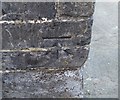
This OS cut mark can be found on the gatepost at the junction of Church Close & North Street. It marks a point 25.564m above mean sea level.
Image: © Adrian Dust Taken: 25 Mar 2019
0.07 miles
8
Totnes from the east
A view of the town across Higher Weston and Bridgetown from the green lane to Fleet Mill. Beyond the green hills is Dartmoor.
Image: © Derek Harper Taken: 25 Jan 2009
0.07 miles
9
St Mary, Totnes
Image: © John Salmon Taken: Unknown
0.07 miles
10
Northgate Lodge, Totnes
Between Castle Street (right) and the path shown in Image], this "early C19 villa" is described at https://www.historicengland.org.uk/listing/the-list/list-entry/1107466 . The impressive garden entrance consists of "round-arched gateway with rusticated voussoirs and surround, cornice and blocking course; double panelled doors with Greek fret decoration".
Image: © Derek Harper Taken: 23 Aug 2016
0.08 miles
  • ...