IMAGES TAKEN NEAR TO
Castle Court, TOTNES, TQ9 5PD
Introduction
This page details the photographs taken nearby to Castle Court, TQ9 5PD by members of the Geograph project.
The Geograph project started in 2005 with the aim of publishing, organising and preserving representative images for every square kilometre of Great Britain, Ireland and the Isle of Man.

There are currently over 7.5m images from over14,400 individuals and you can help contribute to the project by visiting https://www.geograph.org.uk
Image Map
Images are licensed for reuse under creativecommons.org/licenses/by-sa/2.0
Notes
- Clicking on the map will re-center to the selected point.
- The higher the marker number, the further away the image location is from the centre of the postcode.
Image Listing (726 Images Found)
Images are licensed for reuse under creativecommons.org/licenses/by-sa/2.0
Image
Details
Distance

3
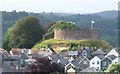
Totnes Castle
Seen from Kingsbridge Hill. The original castle was built soon after the Norman conquest. "The earliest shell-keep, built by Reginald de Braose
circa 1219, was extensively rebuilt together with the rest of the castle by Baron Zouche in 1326 ... Keep of Devonion limestone rubble with red sandstone dressings and battered external face. Crenellated battlements with merlons pierced for loom; approached by 2 stairways in the thickness of the
wall" http://www.britishlistedbuildings.co.uk/en-99088-the-castle-totnes .
Image: © Derek Harper
Taken: 16 Jul 2010
0.02 miles
5
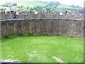
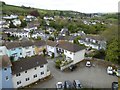
Castle interior
The interior of the castle, seen from the wallwalk.
The shell keep castle is situated on high ground commanding the head of the navigable reaches of the River Dart and overlooking Totnes town. Dating from the 11th century, most of the surviving masonry is 14th century. The castle is listed, grade I, and is a Scheduled Ancient Monument. There is much detail and history at: https://www.historicengland.org.uk/listing/the-list/list-entry/1168856 and at: https://www.historicengland.org.uk/listing/the-list/list-entry/1014607
Image: © Michael Dibb
Taken: 31 May 2017
0.02 miles
6
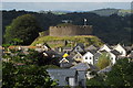
Totnes castle
Seen from Kingsbridge Hill. "The surviving upstanding masonry is mostly of C14 date and comprises a circular masonry shell-keep and sections of the bailey curtain wall. Keep of Devonion limestone rubble with red sandstone dressings and battered external face. Crenellated battlements with merlons pierced for loom" https://www.historicengland.org.uk/listing/the-list/list-entry/1168856 . Can anyone clarify what "loom" means in this context?
Image: © Derek Harper
Taken: 9 Aug 2017
0.02 miles
7
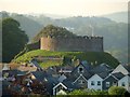
Totnes Castle
Slightly tighter in than Image - and the wind has changed.
Image: © Derek Harper
Taken: 26 May 2012
0.02 miles
8
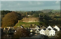
Castle, Totnes
Gables stand out in the foreground this view from Kingsbridge Hill. The "circular masonry shell-keep " of the grade I listed castle https://historicengland.org.uk/listing/the-list/list-entry/1168856?section=official-list-entry dominates.
Image: © Derek Harper
Taken: 10 Nov 2023
0.02 miles