
IMAGES TAKEN NEAR TO
Broomborough Drive, TOTNES, TQ9 5LT
Introduction
This page details the photographs taken nearby to Broomborough Drive, TQ9 5LT by members of the Geograph project.
The Geograph project started in 2005 with the aim of publishing, organising and preserving representative images for every square kilometre of Great Britain, Ireland and the Isle of Man.

There are currently over 7.5m images from over14,400 individuals and you can help contribute to the project by visiting https://www.geograph.org.uk
Image Map
Images are licensed for reuse under creativecommons.org/licenses/by-sa/2.0
Notes
- Clicking on the map will re-center to the selected point.
- The higher the marker number, the further away the image location is from the centre of the postcode.
Image Listing (51 Images Found)
Images are licensed for reuse under creativecommons.org/licenses/by-sa/2.0
Image
Details
Distance
1
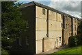
Broomborough Court
A view of the southwestern corner of the south range of the former Totnes Union Workhouse, later Broomborough Hospital and now flats; see also Image] and the listed building description at https://historicengland.org.uk/listing/the-list/list-entry/1264283?section=official-list-entry .
Image: © Derek Harper
Taken: 10 Aug 2021
0.06 miles
2
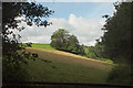
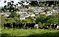
Field by Colwell Wood
A field to the west of the Woodland Trust property.
Image: © Derek Harper
Taken: 10 Aug 2021
0.06 miles
3
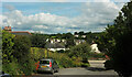
Kellock Drive, Totnes
The cul-de-sac drops to the Plymouth Road.
Image: © Derek Harper
Taken: 10 Aug 2021
0.06 miles
4
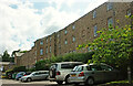
Broomborough Court
The northern side of the former workhouse and hospital shown in Image] and Image https://historicengland.org.uk/listing/the-list/list-entry/1264283?section=official-list-entry .
Image: © Derek Harper
Taken: 10 Aug 2021
0.08 miles
6
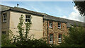
Broomborough Court
"The Old South Range of ... the former Totnes Union Workhouse ... 1838-1839", then Broomborough Hospital https://historicengland.org.uk/listing/the-list/list-entry/1264283?section=official-list-entry. "Over the ridge of the centre block there is an ornate wrought iron weathervane." Now converted into 33 flats.
Image: © Derek Harper
Taken: 10 Aug 2021
0.08 miles
7
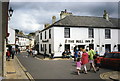
Totnes: Cistern Street
The Bull Inn stands by the no-through Rotherfold
Image: © Martin Bodman
Taken: Unknown
0.09 miles
8
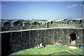
The Ramparts of Totnes Castle
This English Heritage Property is one of the best-preserved Norman shell keeps. It is a motte and bailey castle and there are great views over the River Dart. Cottages and gardens occupy the great ditch that once surrounded the castle. About two thirds of the castle is in this square.
Image: © Pam Brophy
Taken: Unknown
0.09 miles
9
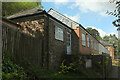
House on Kellock Drive, Totnes
I assume this was a hospital outbuilding before being converted to a dwelling. Broomborough Hospital close in 1993.
Image: © Derek Harper
Taken: 10 Aug 2021
0.11 miles
10
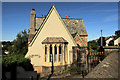
Totnes Cemetery Lodge
Listed and described at https://historicengland.org.uk/listing/the-list/list-entry/1235623 .
Image: © Derek Harper
Taken: 30 Jul 2020
0.11 miles