IMAGES TAKEN NEAR TO
Moat Hill, TOTNES, TQ9 5ER
Introduction
This page details the photographs taken nearby to Moat Hill, TQ9 5ER by members of the Geograph project.
The Geograph project started in 2005 with the aim of publishing, organising and preserving representative images for every square kilometre of Great Britain, Ireland and the Isle of Man.

There are currently over 7.5m images from over14,400 individuals and you can help contribute to the project by visiting https://www.geograph.org.uk
Image Map
Images are licensed for reuse under creativecommons.org/licenses/by-sa/2.0
Notes
- Clicking on the map will re-center to the selected point.
- The higher the marker number, the further away the image location is from the centre of the postcode.
Image Listing (452 Images Found)
Images are licensed for reuse under creativecommons.org/licenses/by-sa/2.0
Image
Details
Distance
1
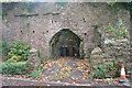
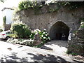
Wheelie-bin cave
A high retaining wall at the southern end of Shute Road incorporates the draw hole of a lime kiln. The recess makes a handy storage space for the wheelie bins too.
Image: © Richard Dorrell
Taken: 5 Nov 2013
0.02 miles
2
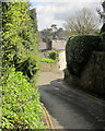
Moat Hill, Totnes
Approaching the junction with Sharpham Drive. Down the hill is Image
Image: © Derek Harper
Taken: 8 Apr 2014
0.03 miles

4
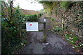
Start of the cycle path to Ashprington
Starting close to Baltic Wharf. Mostly following the higher ground along the Dart Valley.
Image: © jeff collins
Taken: 22 Oct 2014
0.03 miles
5
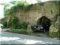
Totnes - Lime kilns
A pair of disused lime kilns put to a novel use.
Image: © Chris Allen
Taken: 1 Sep 2012
0.03 miles
7
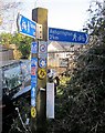
Footpath signpost, Totnes
A signpost exceptionally well-adorned with waymarks and notices, this is at the start of the route to Ashprington, which is in the process of being transformed into a much-improved cycle track. Waymarks include those for the John Musgrave Heritage Trail and the Dart Valley Trail.
Image: © Derek Harper
Taken: 17 Feb 2015
0.04 miles
8

New Walk, Totnes
Modern housing at the southern edge of the town centre.
Image: © Richard Dorrell
Taken: 5 Nov 2013
0.04 miles
9
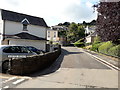
Warland at the junction with Shute Road, Totnes
Image: © John C
Taken: 5 Aug 2019
0.04 miles