
IMAGES TAKEN NEAR TO
Bridgetown, TOTNES, TQ9 5AA
Introduction
This page details the photographs taken nearby to TQ9 5AA by members of the Geograph project.
The Geograph project started in 2005 with the aim of publishing, organising and preserving representative images for every square kilometre of Great Britain, Ireland and the Isle of Man.

There are currently over 7.5m images from over14,400 individuals and you can help contribute to the project by visiting https://www.geograph.org.uk
Image Map
Images are licensed for reuse under creativecommons.org/licenses/by-sa/2.0
Notes
- Clicking on the map will re-center to the selected point.
- The higher the marker number, the further away the image location is from the centre of the postcode.
Image Listing (583 Images Found)
Images are licensed for reuse under creativecommons.org/licenses/by-sa/2.0
Image
Details
Distance
1
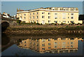
Seymour Court
The listed former hotel https://historicengland.org.uk/listing/the-list/list-entry/1168633 , now a block of 41 flats, is reflected in the tidal waters of the River Dart. On the left is Totnes Bridge.
Image: © Derek Harper
Taken: 10 Aug 2020
0.01 miles
2
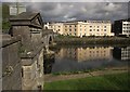
By Totnes Bridge, Totnes
Looking across the Dart to Seymour Court, with the downstream side of Totnes Bridge on the left. Near at hand is one of the "wide, pedimented piers with niches" on the grade II* listed bridge http://list.english-heritage.org.uk/resultsingle.aspx?uid=1107495&searchtype=mapsearch .
Image: © Derek Harper
Taken: 1 May 2014
0.01 miles
3
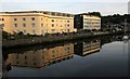
Seymour Court, Totnes
Reflected in late sunshine in the waters of the Dart, and seen from Totnes Bridge.
Image: © Derek Harper
Taken: 25 Aug 2017
0.01 miles
4
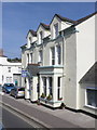
The Four Seasons Guest House, Totnes
Image: © Roger Cornfoot
Taken: 21 May 2010
0.01 miles
5
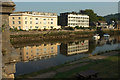
Flats, Totnes
From the grade II* listed Totnes Bridge, with Seymour Court https://historicengland.org.uk/listing/the-list/list-entry/1168633 , formerly a hotel, on the left, and Elizabethan House right of centre.
Image: © Derek Harper
Taken: 10 Aug 2020
0.01 miles
6
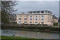
Seymour Hotel
Grade II listed. https://www.britishlistedbuildings.co.uk/101168633-seymour-hotel-totnes
Image: © N Chadwick
Taken: 13 Jan 2018
0.01 miles
7
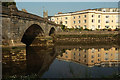
Totnes Bridge
Looking right from Image The grade II* listed Totnes Bridge https://historicengland.org.uk/listing/the-list/list-entry/1107495 straddles the River Dart, with Seymour Court https://historicengland.org.uk/listing/the-list/list-entry/1168633 , formerly a hotel, reflected in the river. Peeping above the bridge is the tower of St John's church.
Image: © Derek Harper
Taken: 10 Aug 2020
0.02 miles
8
![River Dart [2]](https://s3.geograph.org.uk/geophotos/05/43/88/5438855_61a087f5_120x120.jpg)
River Dart [2]
A view of the river and Totnes Bridge from Vire Island, a public park.
Image: © Michael Dibb
Taken: 31 May 2017
0.02 miles
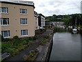
10

Pathfields Road, Totnes
Turn right for the Stemar Quay.
Image: © John Lucas
Taken: 9 Jul 2025
0.02 miles