
IMAGES TAKEN NEAR TO
Buckley Street, SALCOMBE, TQ8 8DD
Introduction
This page details the photographs taken nearby to Buckley Street, TQ8 8DD by members of the Geograph project.
The Geograph project started in 2005 with the aim of publishing, organising and preserving representative images for every square kilometre of Great Britain, Ireland and the Isle of Man.

There are currently over 7.5m images from over14,400 individuals and you can help contribute to the project by visiting https://www.geograph.org.uk
Image Map
Images are licensed for reuse under creativecommons.org/licenses/by-sa/2.0
Notes
- Clicking on the map will re-center to the selected point.
- The higher the marker number, the further away the image location is from the centre of the postcode.
Image Listing (270 Images Found)
Images are licensed for reuse under creativecommons.org/licenses/by-sa/2.0
Image
Details
Distance
2
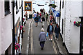
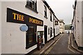
Salcombe: looking down Union Street
On the left one of Salcombe’s pubs, the Fortescue, at the junction of Fore Street and Union Street. Looking east-south-east
Image: © Martin Bodman
Taken: 10 Jul 2007
0.02 miles
4
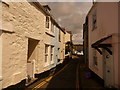
Salcombe: Buckley Street
A typically narrow street in Salcombe.
Image: © Chris Downer
Taken: 24 Aug 2009
0.03 miles
5
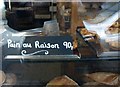
Bread with reason, Salcombe
Rather alarmed to discover that this spelling of "pain aux raisins" is very widespread on the net; nearly as many hits as the correct version. I suppose it might also be translated as "the right bread", which, as far as I am concerned, it certainly is, for breakfast.
Image: © Derek Harper
Taken: 2 Oct 2010
0.03 miles
6
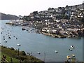
Salcombe from across Batson Creek
From the track to Snapes Point. Island Quay is the nearest part to the camera.
Image: © Derek Harper
Taken: 2 Oct 2010
0.03 miles
7
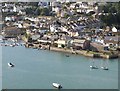
Island Quay, Salcombe
This part of Salcombe has not been an island for centuries, but the quay, and Island Street, reflect its origins. A sailing boat is being towed along the Kingsbridge Estuary. View from the path to Snapes Point.
Image: © Derek Harper
Taken: 2 Oct 2010
0.03 miles
8
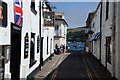
Union Street, Salcombe
One of the many narrow streets in the town. Many of them end abruptly at the river.
Image: © Bill Boaden
Taken: 26 Jun 2011
0.03 miles
9
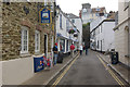
Union Street, Salcombe
Atmospheric street leading back from the waterfront.
Image: © Stephen McKay
Taken: 3 Jul 2013
0.03 miles
10
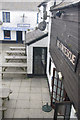
The Fortescue, Salcombe
Town centre pub and the Sea Chest on Union Street.
Image: © Stephen McKay
Taken: 3 Jul 2013
0.03 miles