
IMAGES TAKEN NEAR TO
Westentown, KINGSBRIDGE, TQ7 4LU
Introduction
This page details the photographs taken nearby to Westentown, TQ7 4LU by members of the Geograph project.
The Geograph project started in 2005 with the aim of publishing, organising and preserving representative images for every square kilometre of Great Britain, Ireland and the Isle of Man.

There are currently over 7.5m images from over14,400 individuals and you can help contribute to the project by visiting https://www.geograph.org.uk
Image Map
Images are licensed for reuse under creativecommons.org/licenses/by-sa/2.0
Notes
- Clicking on the map will re-center to the selected point.
- The higher the marker number, the further away the image location is from the centre of the postcode.
Image Listing (42 Images Found)
Images are licensed for reuse under creativecommons.org/licenses/by-sa/2.0
Image
Details
Distance
1
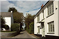
Houses at Kingston Plain
On the right is Pounds Farmhouse, on the left Trebles Cottage.
Image: © Derek Harper
Taken: 3 Oct 2019
0.01 miles
2
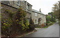
Langs, Kingston
Two houses on the village street as it climbs towards Kingston Plain.
Image: © Derek Harper
Taken: 3 Oct 2019
0.05 miles
3
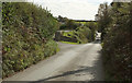
Lane approaching Kingston Plain
Passing Cherrytree Close.
Image: © Derek Harper
Taken: 3 Oct 2019
0.08 miles
4
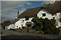
The Old Forge, Kingston
Listed and described at https://historicengland.org.uk/listing/the-list/list-entry/1108107 . Also shown in Image
Image: © Derek Harper
Taken: 3 Oct 2019
0.09 miles
5
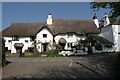
Pair of cottages, Kingston Plain
The Old Forge http://www.britishlistedbuildings.co.uk/en-99619-the-old-forge-kingston and The Farriers http://www.britishlistedbuildings.co.uk/en-99620-the-farriers-kingston (also shown in Image) are a pair of possibly C16 cottages.
Image: © Derek Harper
Taken: 17 Apr 2011
0.09 miles
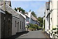
7
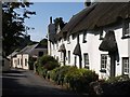
Village Street, Kingston
A reverse view of Image, with the thatched cottages of Chapel Row on the right. http://www.imagesofengland.org.uk/details/default.aspx?id=99618 Only the tip of the gable of the former chapel that gives them their name can be seen.
Image: © Derek Harper
Taken: 24 Sep 2009
0.09 miles
8
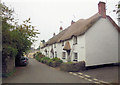
Honeysuckle Cottage Nos 1 to 5
This pictursque row of 17th &18th and 19th C. cottages are listed collectively as Grade II with English Heritage Building ID: 99618. there is more information at http://www.britishlistedbuildings.co.uk/en-99618-honeysuckle-cottage-nos-1-to-5-consecutive
Image: © Stuart Logan
Taken: 7 Oct 2013
0.09 miles
9
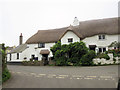
The Farriers and the Old Forge
These two fine buildings hold a visually important position in the settlement with The Farriers being to the left in the picture. it is a Grade II listed cottage with English Heritage Building ID: 99620, possibly dating from the 16th C. Next door The Old Forge is about the same age and similarly Grade II listed. It has English Heritage Building ID: 99619.
Image: © Stuart Logan
Taken: 7 Oct 2013
0.09 miles
10
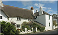
Cottages, Kingston Plain
Also shown at http://www.geograph.org.uk/gridref/SX6447?centi=SX640479 . The Farriers, on the left, is described at https://historicengland.org.uk/listing/the-list/list-entry/1309136 . "A fine building holding an important position visually in the settlement".
Image: © Derek Harper
Taken: 3 Oct 2019
0.09 miles