
IMAGES TAKEN NEAR TO
Malborough, KINGSBRIDGE, TQ7 3RH
Introduction
This page details the photographs taken nearby to TQ7 3RH by members of the Geograph project.
The Geograph project started in 2005 with the aim of publishing, organising and preserving representative images for every square kilometre of Great Britain, Ireland and the Isle of Man.

There are currently over 7.5m images from over14,400 individuals and you can help contribute to the project by visiting https://www.geograph.org.uk
Image Map
Images are licensed for reuse under creativecommons.org/licenses/by-sa/2.0
Notes
- Clicking on the map will re-center to the selected point.
- The higher the marker number, the further away the image location is from the centre of the postcode.
Image Listing (94 Images Found)
Images are licensed for reuse under creativecommons.org/licenses/by-sa/2.0
Image
Details
Distance
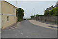
2
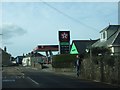
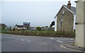
Service Station at Malborough
In Image the fuel price is 121.9 or 124.9 (Nov 2010). Here the prices are 131.9 or 135.9. Watch this space!
Image: © David Smith
Taken: 12 Feb 2011
0.03 miles
6
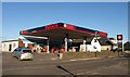
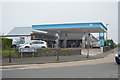
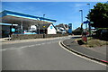
Service station, Malborough
A prominent feature beside Townsend Cross at the east end of the village, the service station also has a Co-op supermarket.
Image: © Derek Harper
Taken: 25 Nov 2010
0.03 miles
7
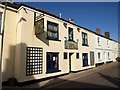
Royal Oak, Malborough
With a couple of attractive signs, the pub is on Higher Town, and can be seen left of centre in Image
Image: © Derek Harper
Taken: 1 Oct 2009
0.04 miles
8
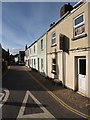
Higher Town, Malborough
Higher and Lower Town are parallel streets in the village. This view is from the crossroads with the main A381 at Townsend Cross. The spire of Image can be seen on the left.
Image: © Derek Harper
Taken: 1 Oct 2009
0.04 miles
9
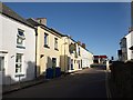
Higher Town, Malborough
A reverse view of Image, with Image on the left. At the end of the street, across the A381 corner, is a petrol station.
Image: © Derek Harper
Taken: 1 Oct 2009
0.04 miles
10
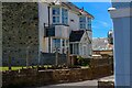
Malborough : Higher Town
Looking along Higher Town off the A381.
Image: © Lewis Clarke
Taken: 8 Jun 2021
0.04 miles