IMAGES TAKEN NEAR TO
Tithe Hill, KINGSBRIDGE, TQ7 3QZ
Introduction
This page details the photographs taken nearby to Tithe Hill, TQ7 3QZ by members of the Geograph project.
The Geograph project started in 2005 with the aim of publishing, organising and preserving representative images for every square kilometre of Great Britain, Ireland and the Isle of Man.

There are currently over 7.5m images from over14,400 individuals and you can help contribute to the project by visiting https://www.geograph.org.uk
Image Map
Images are licensed for reuse under creativecommons.org/licenses/by-sa/2.0
Notes
- Clicking on the map will re-center to the selected point.
- The higher the marker number, the further away the image location is from the centre of the postcode.
Image Listing (30 Images Found)
Images are licensed for reuse under creativecommons.org/licenses/by-sa/2.0
Image
Details
Distance
1
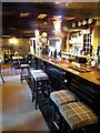
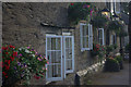
Churchstow: the Church House Inn
The bar. Good meals here, including several vegetarian options. Car park at rear of inn. The inn is built of green slate and dates from the sixteenth century: note the low beams. It has been rebuilt at some time
Image: © Martin Bodman
Taken: 15 Feb 2018
0.12 miles
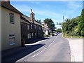
3
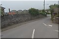
The Church House Inn and the village centre of Churchstow
Image: © David Smith
Taken: 12 Feb 2011
0.12 miles
4
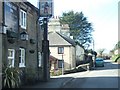
Church House Inn, Churchstow
This inn on the A379 through Churchstow was originally a rest house for Benedictine monks and was later used to house masons building the church opposite - the structure is believed to date from the 13th century. A full history is available here: http://www.churchstow-devon.co.uk/chiprecis.html
Image: © Stephen McKay
Taken: 29 Jun 2013
0.12 miles
5
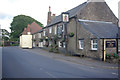
Church House Inn, Churchstow
The front of this old inn seen on a summer evening.
Image: © Stephen McKay
Taken: 29 Jun 2013
0.12 miles
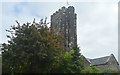
7
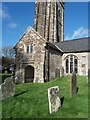
St Mary's Church, Churchstow
The south porch. The church is late fourteenth century, built from the dark local slate. The south aisle is early sixteenth century with granite pillars, slightly leaning southwards
Image: © Martin Bodman
Taken: 15 Feb 2018
0.14 miles
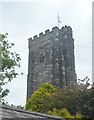
10

Ordnance Survey Cut Mark
This OS cut mark can be found on the south face of St Mary's Church. It marks a point 109.271m above mean sea level.
Image: © Adrian Dust
Taken: 26 Mar 2019
0.15 miles