IMAGES TAKEN NEAR TO
Bantham, KINGSBRIDGE, TQ7 3AA
Introduction
This page details the photographs taken nearby to TQ7 3AA by members of the Geograph project.
The Geograph project started in 2005 with the aim of publishing, organising and preserving representative images for every square kilometre of Great Britain, Ireland and the Isle of Man.

There are currently over 7.5m images from over14,400 individuals and you can help contribute to the project by visiting https://www.geograph.org.uk
Image Map (Loading...)


Getting Data...Please wait
Leaflet Map data © OpenStreetMap
Images are licensed for reuse under creativecommons.org/licenses/by-sa/2.0
Notes
- Clicking on the map will re-center to the selected point.
- The higher the marker number, the further away the image location is from the centre of the postcode.
Image Listing (8 Images Found)
Images are licensed for reuse under creativecommons.org/licenses/by-sa/2.0
Image
Details
Distance
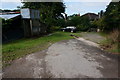
1
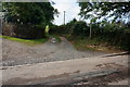
Start of the Bridleway to Worthy
From the minor road between Bantham Cross and Bantham.
Image: © jeff collins
Taken: 6 Aug 2014
0.02 miles
2
Track to Worthy, Aunemouth, near Bantham
Image: © Ruth Sharville
Taken: 10 Oct 2010
0.02 miles
3
Footpath to Osborne Newton
By Reynolds Park the footpath to Osborne Newton
Image: © Shaun Ferguson
Taken: 23 Jul 2009
0.11 miles
4
Fallow Deer
This deer galloped past me then reached a hedge stopped and came back for a better look, unusual behavior they mostly just keep running.
Image: © jeff collins
Taken: 6 Aug 2014
0.12 miles
5
Approaching Worthy
Ahead the path turns left just past the 4x4, behind my position the Bridleway from Heirland Cross comes in.
Image: © jeff collins
Taken: 6 Aug 2014
0.14 miles
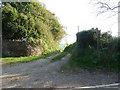
6
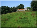
Bridleway nearing Worthy
Bridleway from Heirland Cross nearing Worthy
Image: © Shaun Ferguson
Taken: 23 Jul 2009
0.15 miles
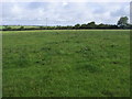
7
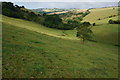
Valley scene
Looking in a Westerly direction. The small stream in the valley bottom drains into Stiddicombe Creek. On the path from Osborne Newton to Reynolds Park.
Image: © jeff collins
Taken: 6 Aug 2014
0.17 miles
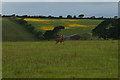
8
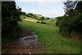
Footpath
After leaving Osborne Newton, heading towards Reynolds Park. The path goes through the gap in the hedge then slightly left up the hill.
Image: © jeff collins
Taken: 6 Aug 2014
0.23 miles