
IMAGES TAKEN NEAR TO
Coleridge Barns, KINGSBRIDGE, TQ7 2HR
Introduction
This page details the photographs taken nearby to Coleridge Barns, TQ7 2HR by members of the Geograph project.
The Geograph project started in 2005 with the aim of publishing, organising and preserving representative images for every square kilometre of Great Britain, Ireland and the Isle of Man.

There are currently over 7.5m images from over14,400 individuals and you can help contribute to the project by visiting https://www.geograph.org.uk
Image Map
Images are licensed for reuse under creativecommons.org/licenses/by-sa/2.0
Notes
- Clicking on the map will re-center to the selected point.
- The higher the marker number, the further away the image location is from the centre of the postcode.
Image Listing (14 Images Found)
Images are licensed for reuse under creativecommons.org/licenses/by-sa/2.0
Image
Details
Distance
1
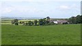
Coleridge House
A view from the lane between Sherford Cross and Coleridge Cross. "Coleridge House was first created as a country retreat and haven for refined living in the mid 18th century. The elegant property sits within its own 5 acre grounds, less than one mile from the very pleasant village of Chillington." http://brochures.rt-sb.net/35024_432511.pdf . The house, which was a nursing home until 2002, has been divided into five dwellings. Neighbouring barns have also been converted.
Image: © Derek Harper
Taken: 16 Jun 2009
0.00 miles
2
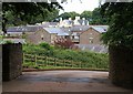
Coleridge Barns and House
A view of Image, and some of its converted barns, from a corner on Coleridge Lane.
Image: © Derek Harper
Taken: 16 Jun 2009
0.01 miles
3

Cattle at Coleridge Farm, 1967
View westward. This was probably in the area completely (people and animals) evacuated in December 1943 for eight months, to accommodate the US Army for training in preparation for D-Day. (Cf. Image).
Image: © Ben Brooksbank
Taken: 13 Jun 1967
0.07 miles
4
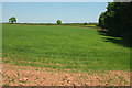
Field near Coleridge Farm
A fresh shade of green about this crop seen from the gateway visible in Image On the right is some woodland surrounding Coleridge House.
Image: © Derek Harper
Taken: 22 May 2018
0.08 miles
5
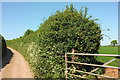
Near Coleridge Farm
A minor lane between the farm and Coleridge House.
Image: © Derek Harper
Taken: 22 May 2018
0.12 miles
6

Oak in fog near Coleridge House
An increasingly foggy day in the South Hams. This is on the lane from Sherford Cross to Coleridge Cross, followed by NCN28. Two junction leave on the right within 10 metres; both run parallel. The further one is the public lane; the nearer is a private track to Coleridge Barns.
Image: © Derek Harper
Taken: 15 Nov 2018
0.12 miles
7
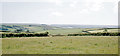
Panorama SW from Coleridge Farm, Chillington 1969
Towards the estuary at Kingsbridge.
Image: © Ben Brooksbank
Taken: 22 Jun 1969
0.16 miles

9

Lane heading to Sherford Cross
Lane heading to Sherford Cross passing drive to Coleridge House
Image: © Shaun Ferguson
Taken: 31 Jul 2009
0.18 miles
10

Lane to Coleridge Cross
Seen from a junction east of Sherford Cross. The lane is followed by NCN2, the 'South Coast Route' for cyclists.
Image: © Derek Harper
Taken: 16 Jun 2009
0.18 miles