
IMAGES TAKEN NEAR TO
Belle Cross Road, KINGSBRIDGE, TQ7 2DY
Introduction
This page details the photographs taken nearby to Belle Cross Road, TQ7 2DY by members of the Geograph project.
The Geograph project started in 2005 with the aim of publishing, organising and preserving representative images for every square kilometre of Great Britain, Ireland and the Isle of Man.

There are currently over 7.5m images from over14,400 individuals and you can help contribute to the project by visiting https://www.geograph.org.uk
Image Map
Images are licensed for reuse under creativecommons.org/licenses/by-sa/2.0
Notes
- Clicking on the map will re-center to the selected point.
- The higher the marker number, the further away the image location is from the centre of the postcode.
Image Listing (17 Images Found)
Images are licensed for reuse under creativecommons.org/licenses/by-sa/2.0
Image
Details
Distance
1
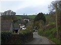
Westerlands
A group of houses in a valley east of Kingsbridge
Image: © David Smith
Taken: 29 Mar 2014
0.03 miles
2
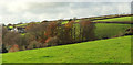
From Sandy Lane
Autumnal trees in the valley near Addlehole Fork, with the first of a line of houses along Belle Cross Lane on the left.
Image: © Derek Harper
Taken: 13 Nov 2018
0.04 miles
3

View over Addlehole
Looking left from where Image was taken, with the eastern suburbs of Kingsbridge on the right.
Image: © Derek Harper
Taken: 13 Nov 2018
0.08 miles
4
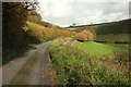
Lane to Luke's Addlehole
Up the valley from Addlehole Fork.
Image: © Derek Harper
Taken: 13 Nov 2018
0.08 miles
5
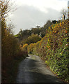
Lane to Addlehole Fork
The lane shown in Image], looking in the other direction.
Image: © Derek Harper
Taken: 13 Nov 2018
0.08 miles
6
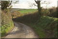
Sandy Lane
The ridge lane, followed by the parish boundary between Kingsbridge (right) and Buckland-Tout-Saints, is dipping towards a little col in the ridge, at Crimps Cross.
Image: © Derek Harper
Taken: 13 Nov 2018
0.10 miles
7

Sandy Lane
As in Image], the lane followed by the parish boundary between Kingsbridge (right) and Buckland-Tout-Saints, drops towards Crimps Cross.
Image: © Derek Harper
Taken: 13 Nov 2018
0.12 miles
8
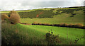
Valley below Luke's Addlehole
Looking right from where Image] was taken, with considerable overlap. The hedge follows the line of the stream.
Image: © Derek Harper
Taken: 13 Nov 2018
0.13 miles
9
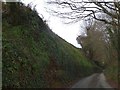
A deep lane west of Cripps Cross
The road drops from the crossroads to the valley at Westerlands
Image: © David Smith
Taken: 29 Mar 2014
0.13 miles
10
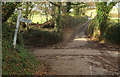
Crimps Cross
A reverse view of Image], with Sandy Lane heading towards Blackridge Cross. Kingsbridge parish is now on the left, and Buckland-Tout-Saints on the right.
Image: © Derek Harper
Taken: 13 Nov 2018
0.14 miles