IMAGES TAKEN NEAR TO
Saunders Way, KINGSBRIDGE, TQ7 2BS
Introduction
This page details the photographs taken nearby to Saunders Way, TQ7 2BS by members of the Geograph project.
The Geograph project started in 2005 with the aim of publishing, organising and preserving representative images for every square kilometre of Great Britain, Ireland and the Isle of Man.

There are currently over 7.5m images from over14,400 individuals and you can help contribute to the project by visiting https://www.geograph.org.uk
Image Map
Images are licensed for reuse under creativecommons.org/licenses/by-sa/2.0
Notes
- Clicking on the map will re-center to the selected point.
- The higher the marker number, the further away the image location is from the centre of the postcode.
Image Listing (34 Images Found)
Images are licensed for reuse under creativecommons.org/licenses/by-sa/2.0
Image
Details
Distance
1
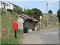
Shelter and drinking fountain
Postbox number TQ7 73.
Image: © Robin Stott
Taken: 19 May 2011
0.02 miles
2
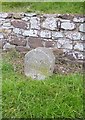
Old Milestone by the A379, West Charleton, Charleton Parish
Carved stone post by the A379, in parish of CHARLETON (SOUTH HAMS District), West Charleton, opposite Primary School, on grass bank, just East of bus stop, under hedge, by wall, on North side of road. Slapton granite marker, erected by the Kingsbridge & Dartmouth turnpike trust in the 19th century.
Inscription reads:-
KINGS
BRIDGE
2
(MILES)
Milestone Society National ID: DV_KBDM02
Image: © Alan Rosevear
Taken: 22 Feb 2013
0.02 miles
3
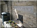
"Thirst for the living water"
A drinking fountain in a shelter by a bus stop, West Charleton.
Image: © Robin Stott
Taken: 19 May 2011
0.02 miles
4
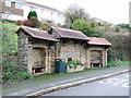
Horse trough, West Charleton
"Thirst for the living water" reads the inscription. A plaque reads "donated by Lord and Lady Compton in 1896 and reconstructed by D. & M. Heath when resited in 1973", probably to make room for a bus stop. At least there is a pavement beside the A379 in this part of the village.
Image: © Derek Harper
Taken: 4 Jan 2007
0.03 miles
7
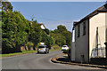
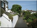
West Charleton : The A379
The A379 heading through the village of West Charleton.
Image: © Lewis Clarke
Taken: 17 Jul 2015
0.04 miles
8
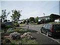
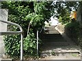
Steep bit of Lyte Lane
At the junction with Saunders Way.
Image: © Robin Stott
Taken: 19 May 2011
0.04 miles