
IMAGES TAKEN NEAR TO
Sherford, KINGSBRIDGE, TQ7 2BL
Introduction
This page details the photographs taken nearby to TQ7 2BL by members of the Geograph project.
The Geograph project started in 2005 with the aim of publishing, organising and preserving representative images for every square kilometre of Great Britain, Ireland and the Isle of Man.

There are currently over 7.5m images from over14,400 individuals and you can help contribute to the project by visiting https://www.geograph.org.uk
Image Map
Images are licensed for reuse under creativecommons.org/licenses/by-sa/2.0
Notes
- Clicking on the map will re-center to the selected point.
- The higher the marker number, the further away the image location is from the centre of the postcode.
Image Listing (15 Images Found)
Images are licensed for reuse under creativecommons.org/licenses/by-sa/2.0
Image
Details
Distance
1
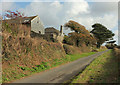
Duncombe
A farm just northwest of Duncombe Cross.
Image: © Derek Harper
Taken: 13 Nov 2018
0.01 miles
2

Duncombe
Converted barn and farmhouse along the lane from Bowcombe to Duncombe Cross.
Image: © Derek Harper
Taken: 4 Jan 2007
0.05 miles
3

Duncombe Cross
The lane shown here leads northeast towards Cole's Cross, from this junction rendered a crossroads by virtue of one of the arms being the green lane to Frogmore.
Image: © Derek Harper
Taken: 13 Nov 2018
0.07 miles
4

Approaching Duncombe Cross
The road from West Charleton climbs onto a wide ridge beyond the crossroads; three of the roads at the cross are metalled, the fourth is a green lane to Frogmore
Image: © David Smith
Taken: 20 Feb 2013
0.07 miles
5

Green Lane from Duncombe Cross
The beginning of a two mile long green lane leading from Duncombe Cross (where it continues along the line of the lane shown in Image) to Frogmore. Here it is dropping to cross the stream that flows through the West Charleton valley.
Image: © Derek Harper
Taken: 4 Jan 2007
0.10 miles
6

Green lane tunnel, Duncombe
Inside the far end of the tunnel shown in Image, surrounded by ferns and ivy.
Image: © Derek Harper
Taken: 4 Jan 2007
0.10 miles
7

Duncombe Cross
Lane from Bowcombe at Duncombe Cross
Image: © Shaun Ferguson
Taken: 30 Jul 2009
0.11 miles
8

The Green Lane from Duncombe Cross
The lane is totally enclosed by vegetation at this point.
Image: © Tony Atkin
Taken: 15 May 2011
0.11 miles
9

Green lane leaves lane near Duncombe
Signed as unmetalled road, a route with public access forks off from the lane climbing from Bowcombe Bridge to Duncombe. The green lane continues the line of the line, while the actual modern road is continuing the line of the footpath shown leaving it in Image
Image: © Derek Harper
Taken: 13 Nov 2018
0.12 miles
10

Green lane near Duncombe
This green lane has been flailed for the first 50 metres or so northwards from the lane at Duncombe Court, but from then on it becomes a tunnel beneath overhanging trees. On the right is a converted barn at Duncombe.
Image: © Derek Harper
Taken: 4 Jan 2007
0.12 miles