
IMAGES TAKEN NEAR TO
Wallingford Road, KINGSBRIDGE, TQ7 1ND
Introduction
This page details the photographs taken nearby to Wallingford Road, TQ7 1ND by members of the Geograph project.
The Geograph project started in 2005 with the aim of publishing, organising and preserving representative images for every square kilometre of Great Britain, Ireland and the Isle of Man.

There are currently over 7.5m images from over14,400 individuals and you can help contribute to the project by visiting https://www.geograph.org.uk
Image Map
Images are licensed for reuse under creativecommons.org/licenses/by-sa/2.0
Notes
- Clicking on the map will re-center to the selected point.
- The higher the marker number, the further away the image location is from the centre of the postcode.
Image Listing (112 Images Found)
Images are licensed for reuse under creativecommons.org/licenses/by-sa/2.0
Image
Details
Distance
1
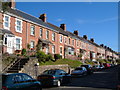
Wallingford Street, Kingsbridge
Brick terraces on the east side of town.
Image: © Derek Harper
Taken: 24 Aug 2006
0.03 miles
2
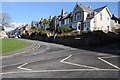
Wallingford Road, Kingsbridge
Houses on Wallingford Road, Kingsbridge.
Image: © Philip Halling
Taken: 16 Feb 2014
0.05 miles
5
![Kingsbridge houses [14]](https://s1.geograph.org.uk/geophotos/07/57/60/7576057_47c2f2b2_120x120.jpg)
Kingsbridge houses [14]
Numbers 7 to 9 Belle Vue Road were built in the early 19th century. Constructed of stuccoed stone under a slate roof. There is a continuous verandah with on cast iron columns. In front are some delicate railings and gates. Listed, grade II, with details at: https://historicengland.org.uk/listing/the-list/list-entry/1165284
Kingsbridge is a market town in the South Hams district of Devon. It is located at the head of an estuary some 17 miles southwest of Torquay and about 17 miles southeast of Plymouth. The town formed around a bridge built in or before the 10th century between two royal estates, giving it the name of Kyngysbrygge ("King's bridge"). Situated in the South Devon Area of Outstanding Natural Beauty and close to the South Devon coast, the town is a popular tourist destination.
Image: © Michael Dibb
Taken: 27 Jun 2023
0.07 miles
6

Scholars' Walk, Kingsbridge
New housing built on the site of - you guessed it - a vanished school. (In this case, the National School).
Image: © Derek Harper
Taken: 24 Aug 2006
0.07 miles
7
![Kingsbridge houses [9]](https://s2.geograph.org.uk/geophotos/07/57/60/7576050_c339947f_120x120.jpg)
Kingsbridge houses [9]
Waterloo Place, numbers 1 to 4 Duncombe Street, are an early 19th century terrace. Constructed of rendered stone under slate roofs. There is a low stone front wall with wrought iron spear railings. Listed, grade II, with details at: https://historicengland.org.uk/listing/the-list/list-entry/1165434
Kingsbridge is a market town in the South Hams district of Devon. It is located at the head of an estuary some 17 miles southwest of Torquay and about 17 miles southeast of Plymouth. The town formed around a bridge built in or before the 10th century between two royal estates, giving it the name of Kyngysbrygge ("King's bridge"). Situated in the South Devon Area of Outstanding Natural Beauty and close to the South Devon coast, the town is a popular tourist destination.
Image: © Michael Dibb
Taken: 27 Jun 2023
0.08 miles
8
![Kingsbridge houses [19]](https://s1.geograph.org.uk/geophotos/07/57/68/7576837_dad381f0_120x120.jpg)
Kingsbridge houses [19]
Rose Terrace, numbers 77 to 83 Church Street, were built in the early 19th century. Constructed of coursed rubble stone under a slate roof. Listed, grade II, with details at: https://historicengland.org.uk/listing/the-list/list-entry/1107513
Kingsbridge is a market town in the South Hams district of Devon. It is located at the head of an estuary some 17 miles southwest of Torquay and about 17 miles southeast of Plymouth. The town formed around a bridge built in or before the 10th century between two royal estates, giving it the name of Kyngysbrygge ("King's bridge"). Situated in the South Devon Area of Outstanding Natural Beauty and close to the South Devon coast, the town is a popular tourist destination.
Image: © Michael Dibb
Taken: 27 Jun 2023
0.08 miles
9
![Kingsbridge houses [20]](https://s0.geograph.org.uk/geophotos/07/57/68/7576840_667838a7_120x120.jpg)
Kingsbridge houses [20]
Rose Cottage, number 75 Church Street, is swathed in scaffolding. Built in the 18th or early 19th century. Constructed of stuccoed stone under a hipped slate roof. There is a central open porch with Tuscan columns. Listed, grade II, with details at: https://historicengland.org.uk/listing/the-list/list-entry/1107512
Kingsbridge is a market town in the South Hams district of Devon. It is located at the head of an estuary some 17 miles southwest of Torquay and about 17 miles southeast of Plymouth. The town formed around a bridge built in or before the 10th century between two royal estates, giving it the name of Kyngysbrygge ("King's bridge"). Situated in the South Devon Area of Outstanding Natural Beauty and close to the South Devon coast, the town is a popular tourist destination.
Image: © Michael Dibb
Taken: 27 Jun 2023
0.08 miles
10
![Kingsbridge houses [17]](https://s0.geograph.org.uk/geophotos/07/57/61/7576112_bbd90a95_120x120.jpg)
Kingsbridge houses [17]
Even numbers 128 to 132 Church Street are a row of three 18th century cottages, numbers 130 and 128 with a shared central entrance. Constructed of rubble stone, numbers 130 and 132 stuccoed, all under a slate roof. Listed, for group value, grade II, with details at: https://historicengland.org.uk/listing/the-list/list-entry/1107510
Kingsbridge is a market town in the South Hams district of Devon. It is located at the head of an estuary some 17 miles southwest of Torquay and about 17 miles southeast of Plymouth. The town formed around a bridge built in or before the 10th century between two royal estates, giving it the name of Kyngysbrygge ("King's bridge"). Situated in the South Devon Area of Outstanding Natural Beauty and close to the South Devon coast, the town is a popular tourist destination.
Image: © Michael Dibb
Taken: 27 Jun 2023
0.09 miles